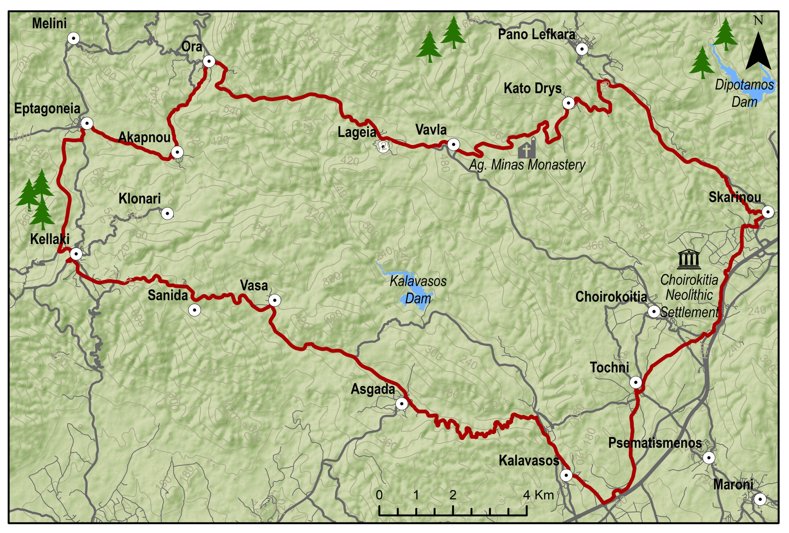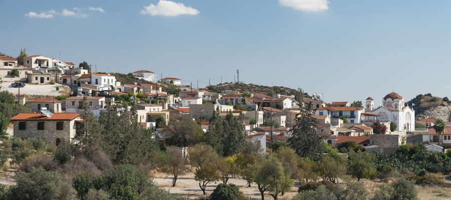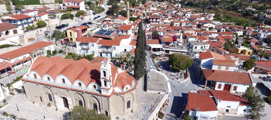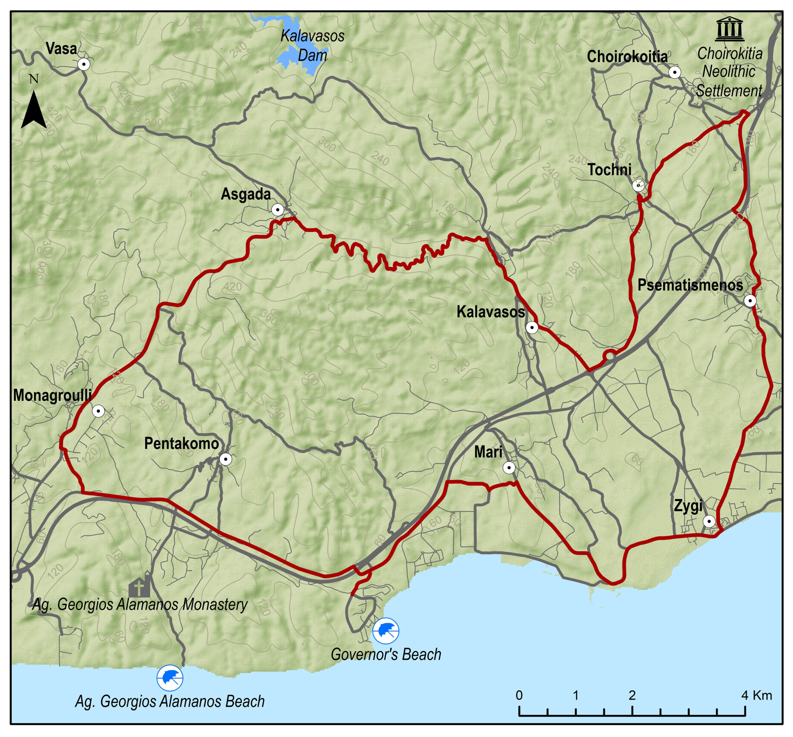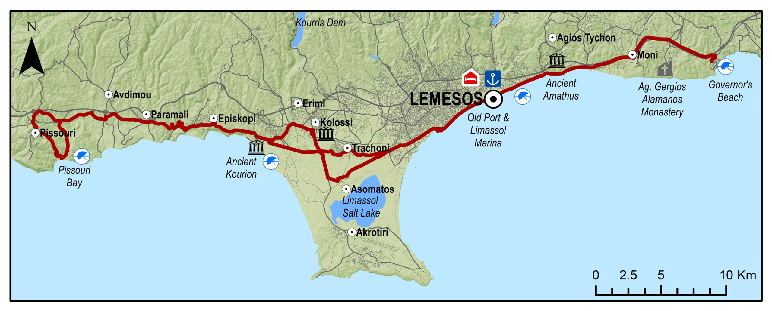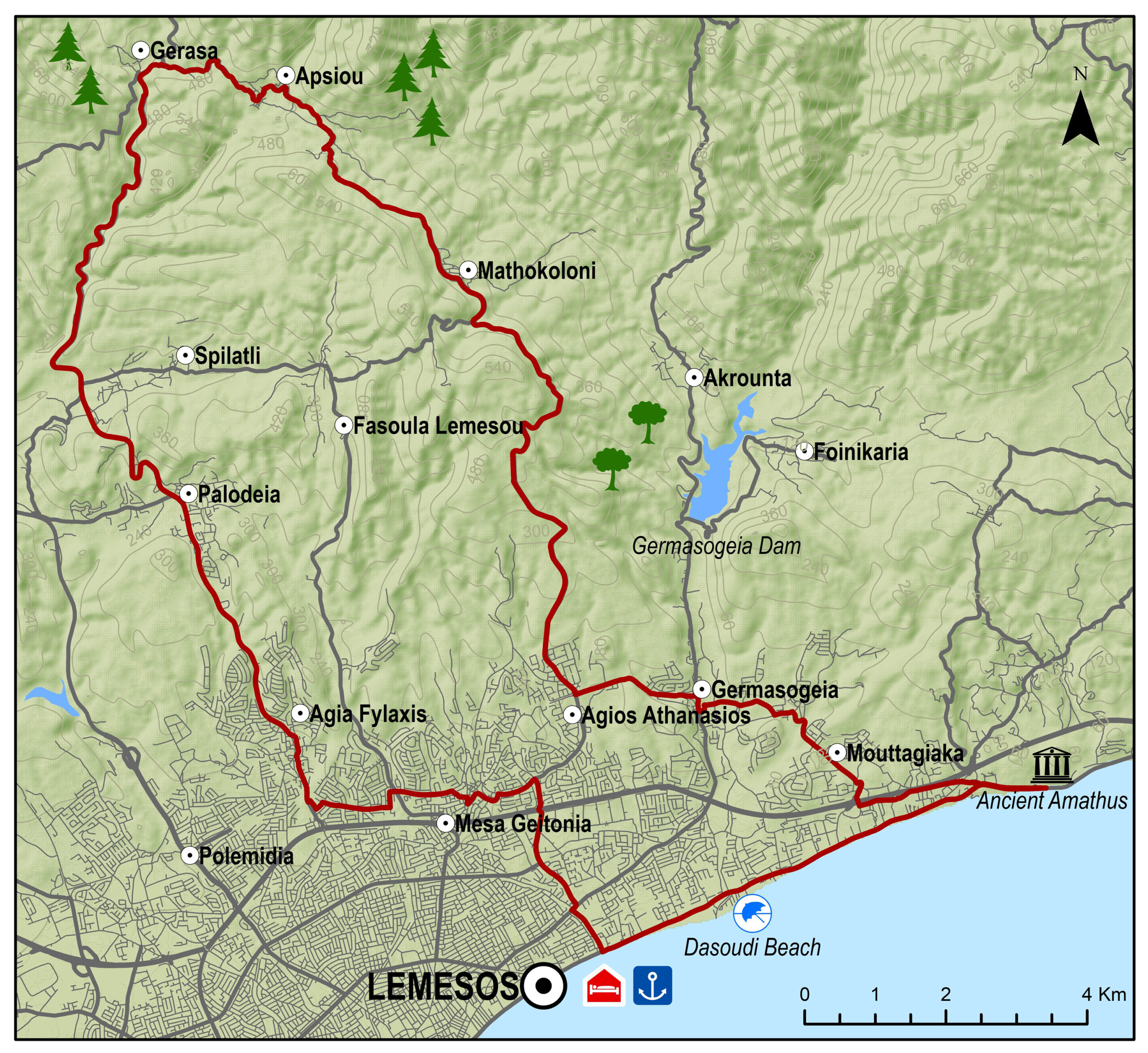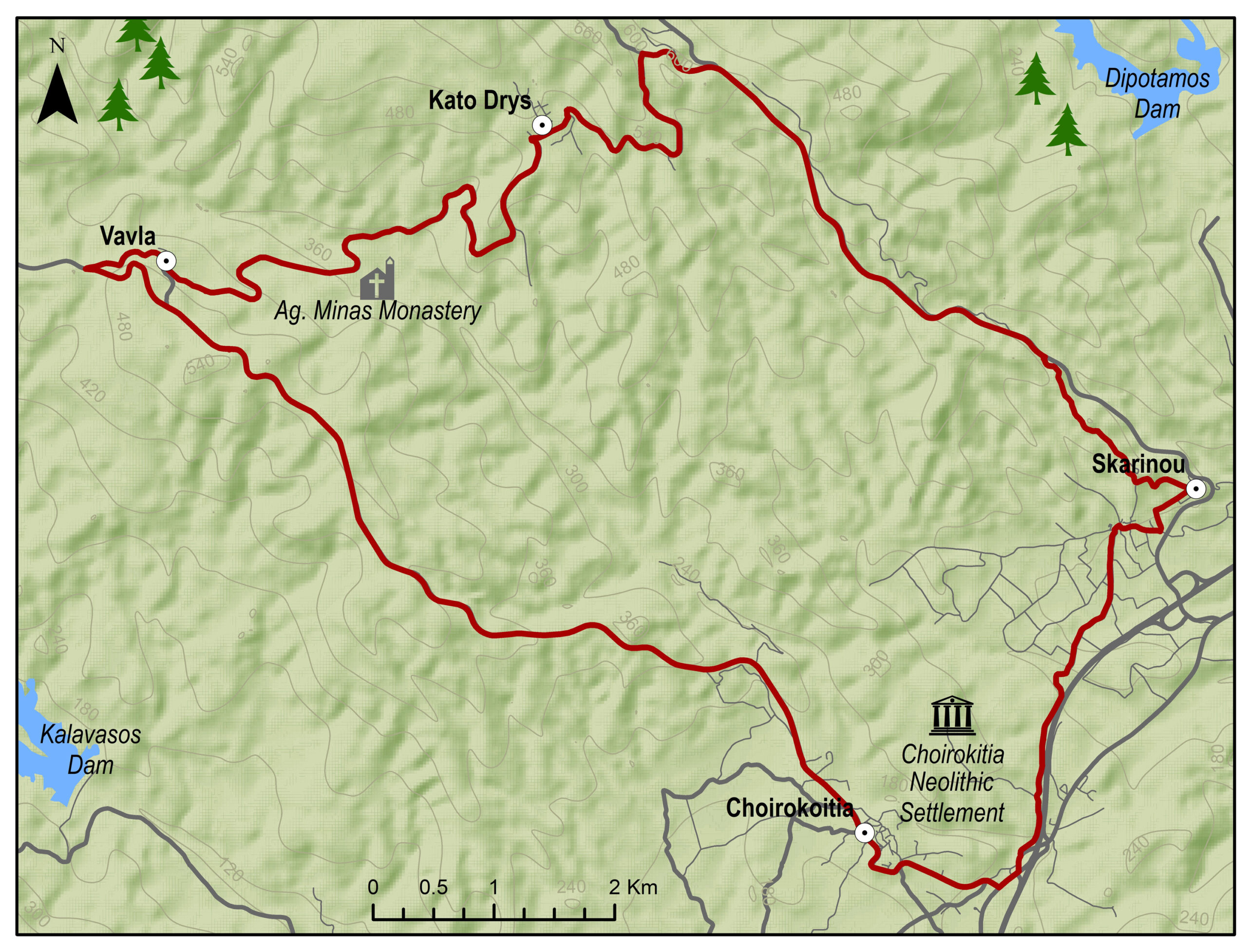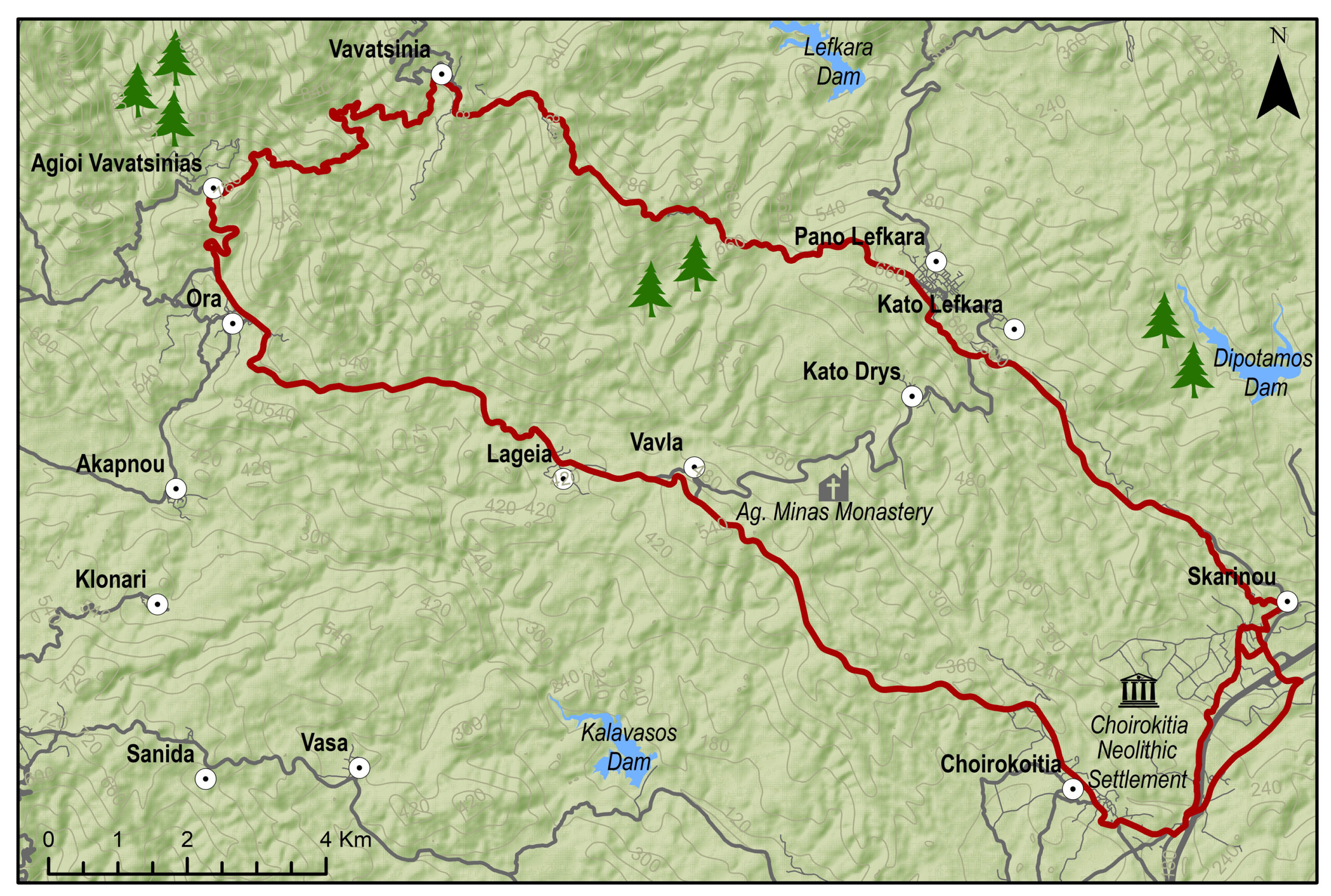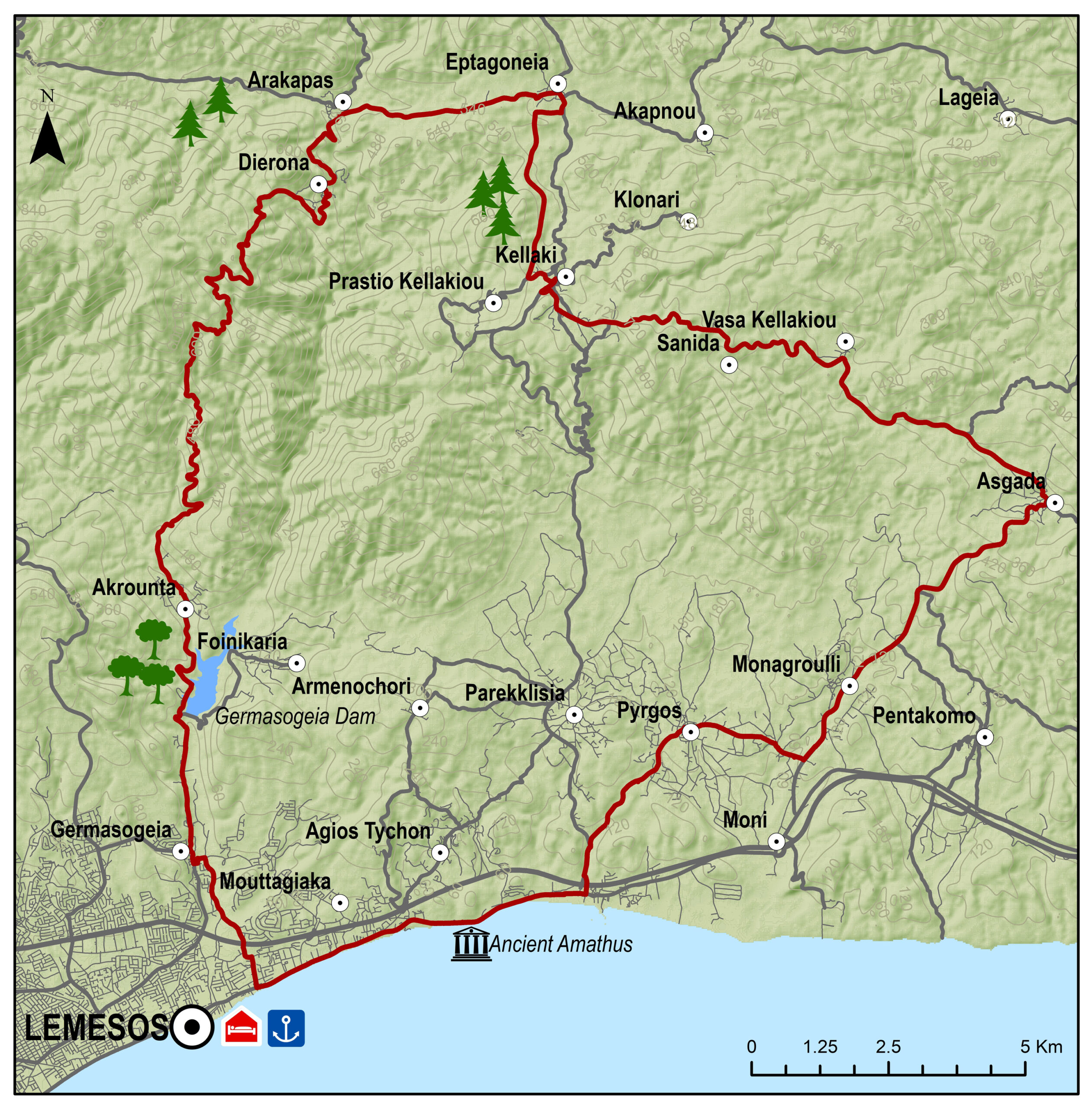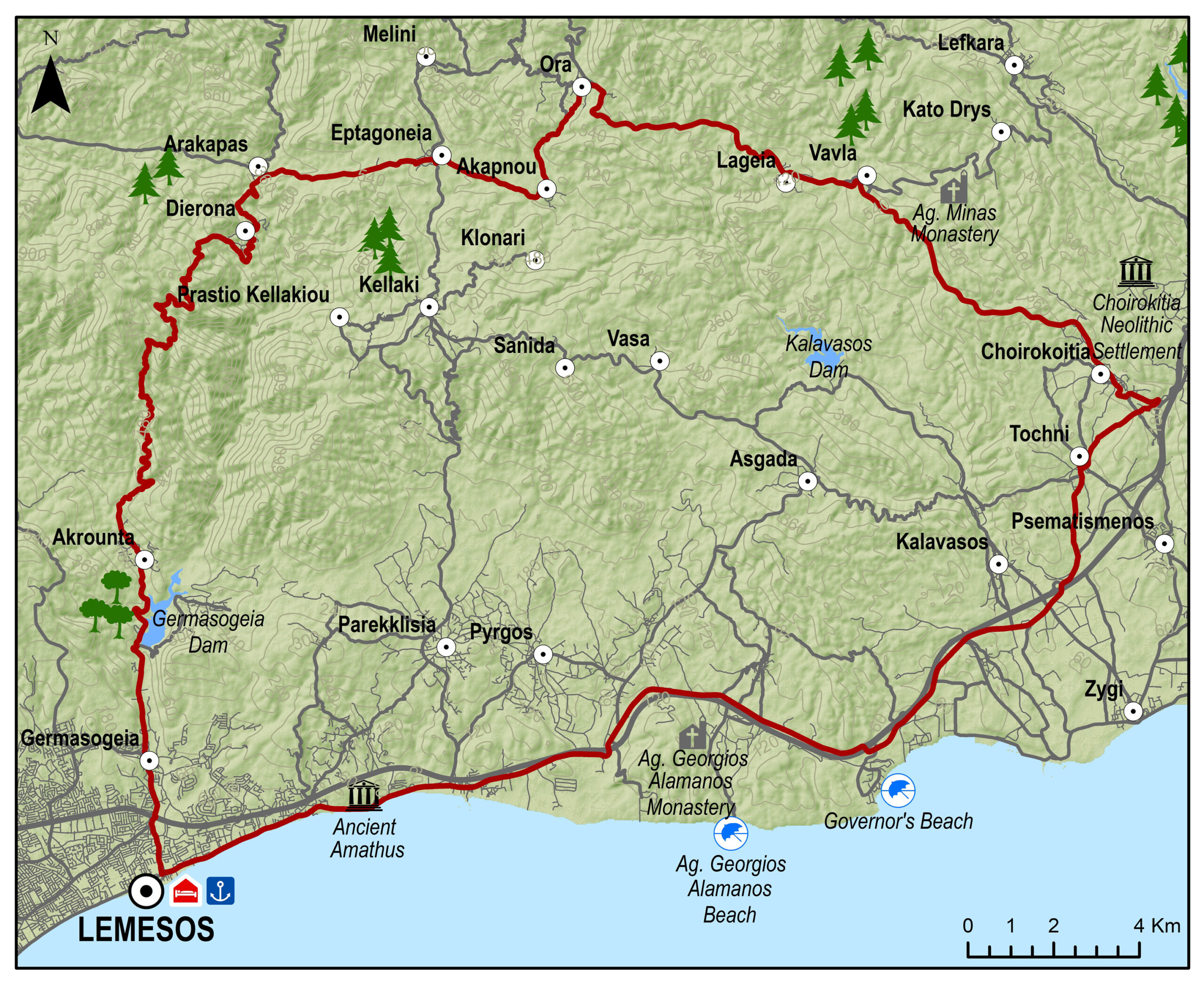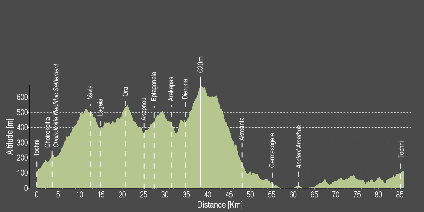
The route starts from the village of Kalavasos with a slight uphill ascent towards the village of Asgata. Pass through the narrow streets of the village and continue uphill to Vasa, Sanida and then to Kellaki. Woodland areas and unique views will be encountered along the way. Ride downhill to reach the Eptagoneia Village and the small picturesque village of Akapnou. Continue towards Ora, Lageia, Vavla and then ride uphill to Kato Drys village. A big downhill ride will follow which leads to the village of Skarinou. Pass through the village and continue to Choirokoitia and then to beautiful Tochni. Continue straight ahead to reach the starting point of the route in Kalavasos.
To download the route in gpx format click here
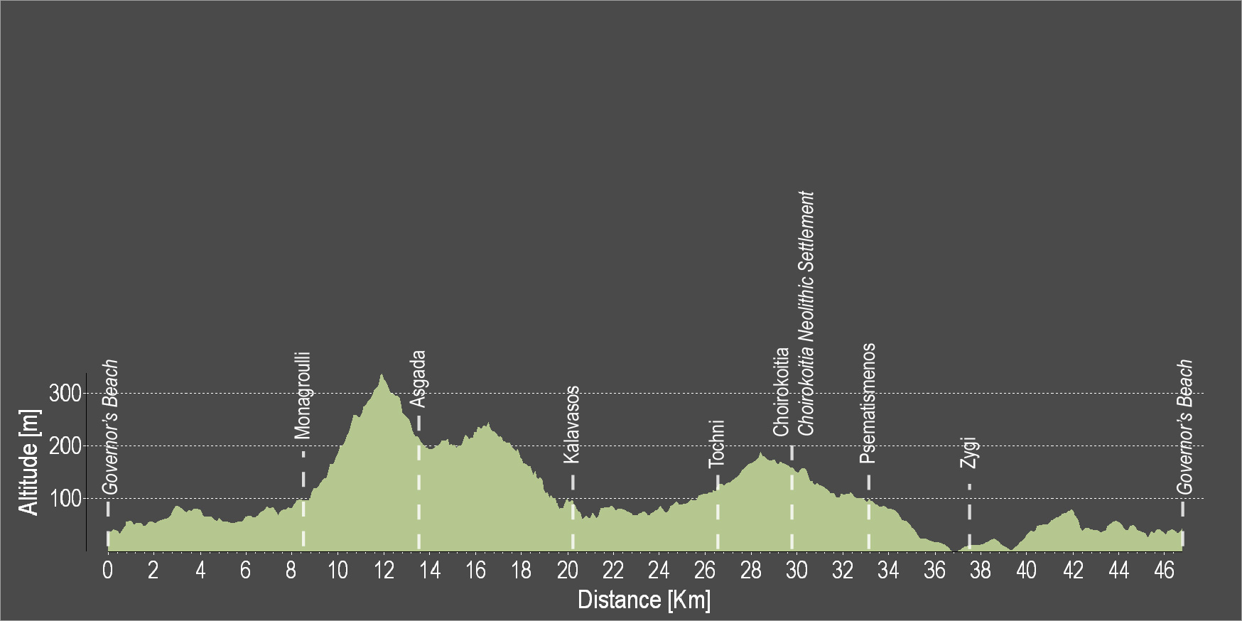
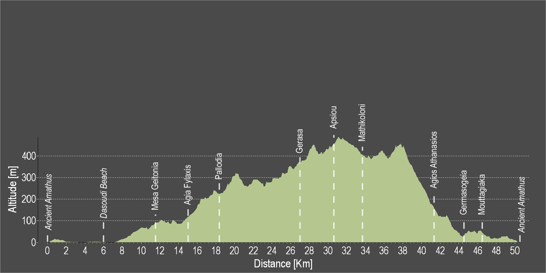
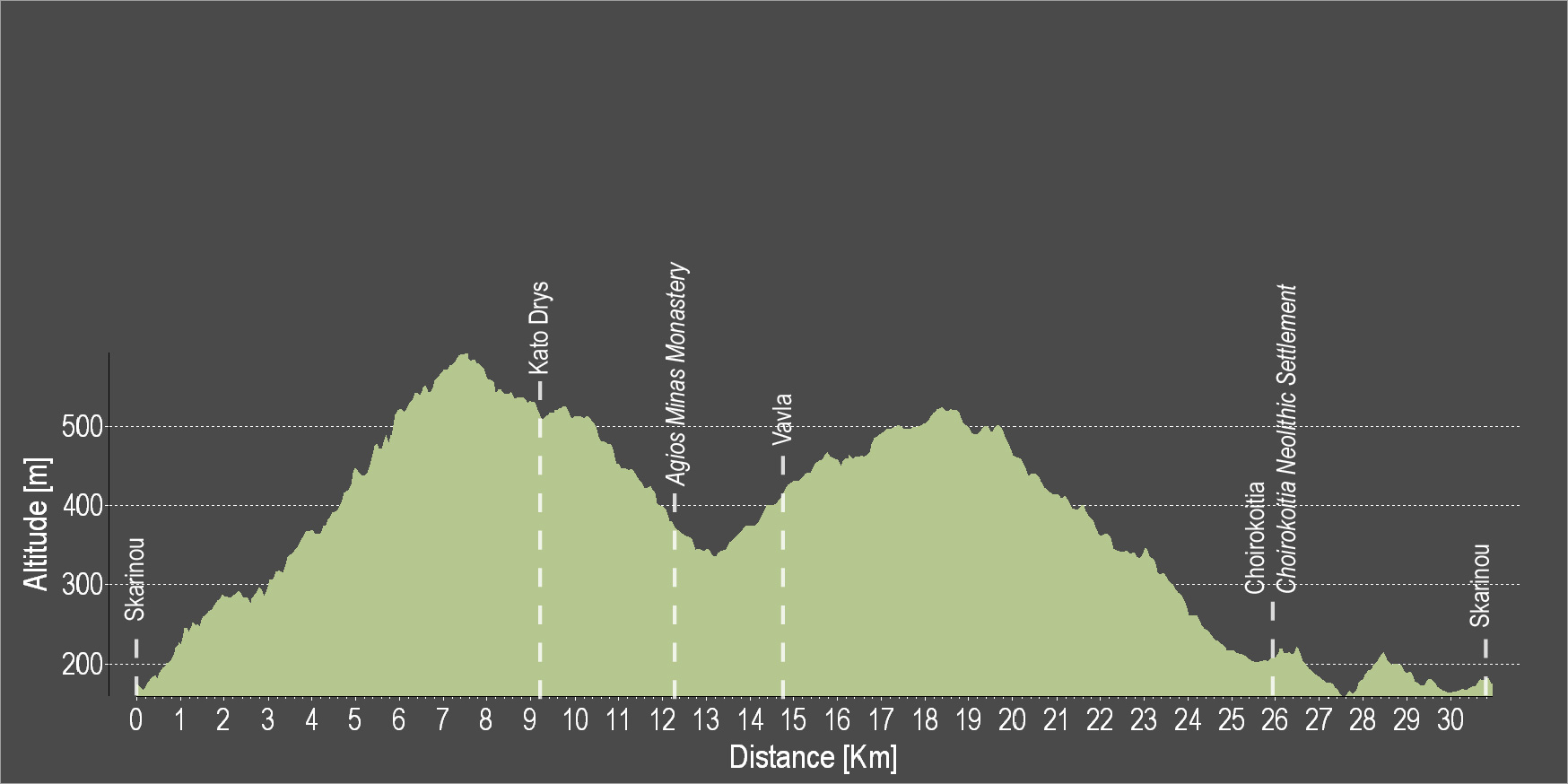
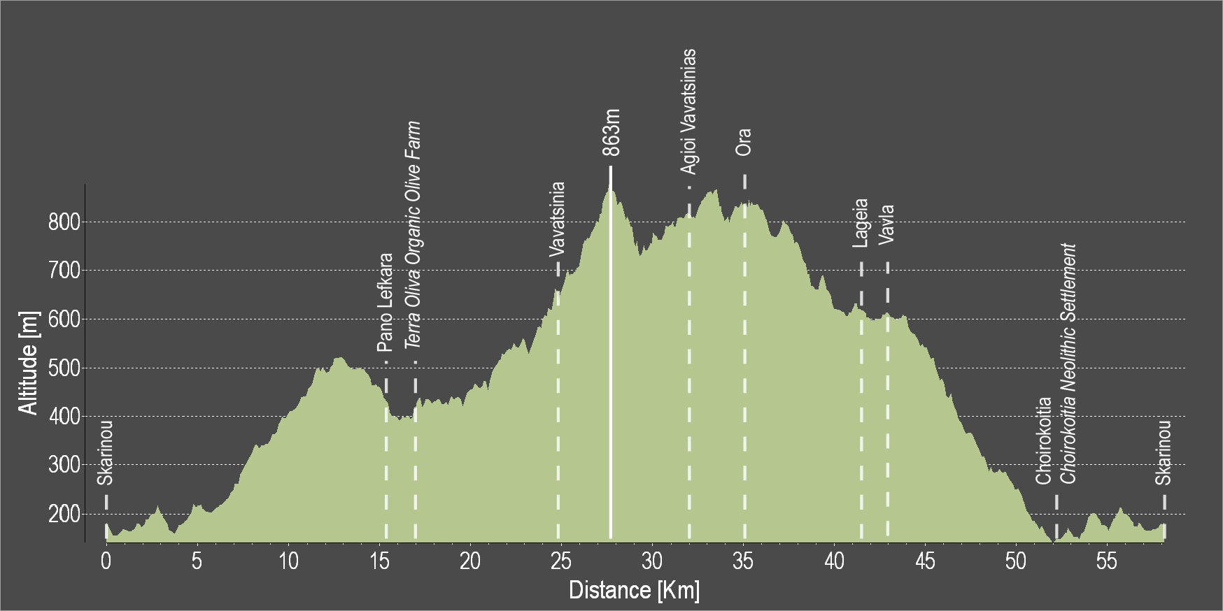
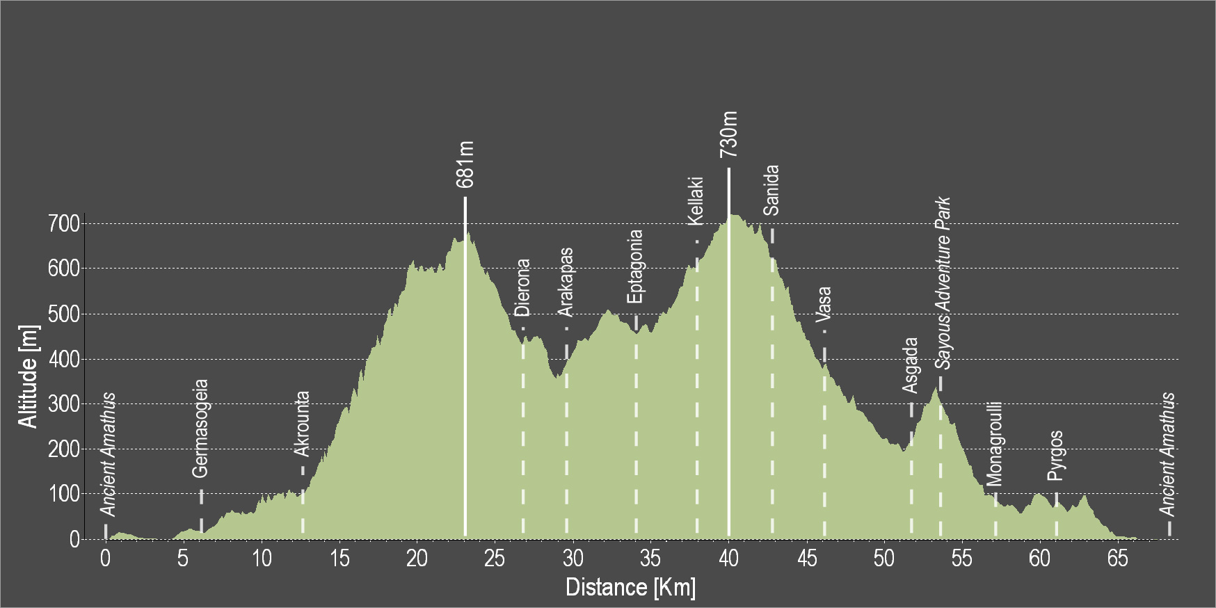
| Distance: | 67.3km |
| Elevation Gain: | 1484m |
| Highest point: | 724m |
| Lowest point: | 65m |
| Loop: | YES |
| Terrain: | Mountain |
| Road surface: | Paved |
| Section Distance (km) | Total Distance (km) | |
| Kalavasos | 0.0 | 0.0 |
| Asgada | 6.6 | 6.6 |
| Vasa | 5.1 | 11.7 |
| Sanida | 3.6 | 15.3 |
| Kellaki | 4.1 | 19.4 |
| Eptagoneia | 4.5 | 23.9 |
| Akapnou | 3.0 | 26.9 |
| Ora | 3.5 | 30.4 |
| Lageia | 6.3 | 36.7 |
| Vavla | 2.4 | 39.1 |
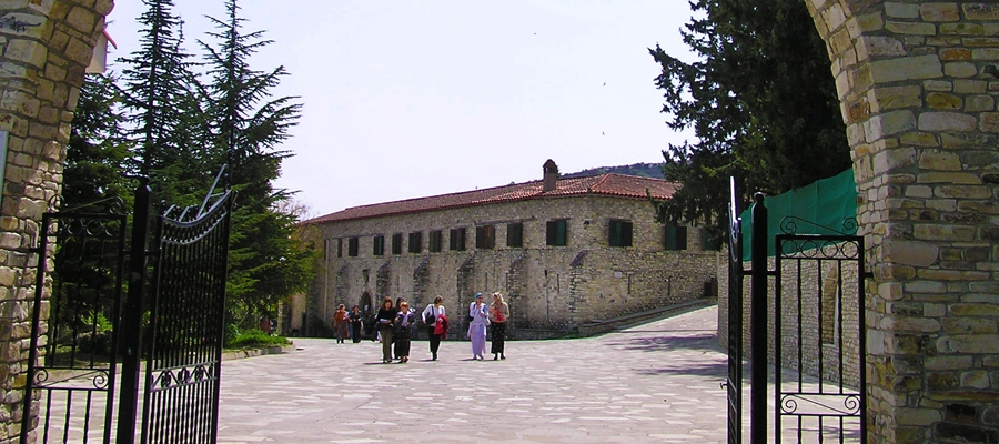
| Agios Minas Monastery | 2.4 | 41.5 |
| Kato Drys | 3.1 | 44.6 |
| Skarinou | 9.0 | 53.6 |
| Choirokoitia | 4.1 | 57.7 |
| Choirokoitia Neolithic Settlement | 0.0 | 57.7 |
| Tochni | 2.7 | 60.4 |
| Kalavasos | 6.9 | 67.3 |