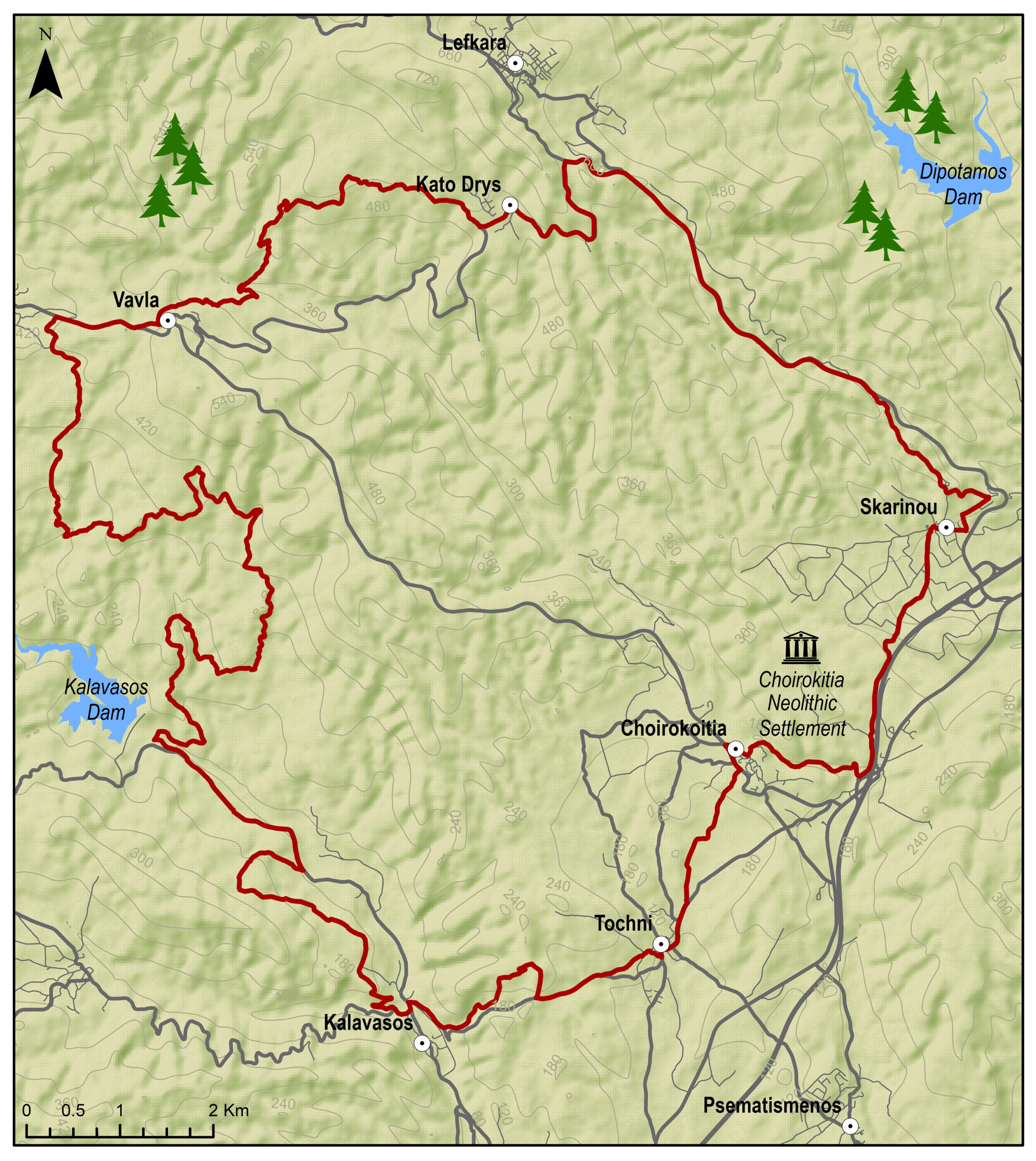
The route starts from the village of Skarinou, ascends to Kato Drys and then descends to Vavla, a designated heritage village due to its white stone houses and its traditional features. Continue towards the Kalavasos Reservoir and then to the picturesque villages of Kalavasos and Tochni. The route then heads to Choirokoitia, passing by the site where the Neolithic Settlement of Choirokoitia lies, which has been listed as a UNESCO World Heritage Site since 1998, and ends again in Skarinou
To download the route in gpx format click here
| Distance: | 48.0km |
| Elevation Gain: | 1182m |
| Highest point: | 583m |
| Lowest point: | 75m |
| Loop: | YES |
| Terrain: | Mountained |
| Section Distance (km) | Total Distance (km) | |
| Skarinou | 0.0 | 0.0 |
| Kato Drys | 9.8 | 9.8 |
| Vavla | 5.5 | 15.3 |
| Kalavasos Dam | 12.8 | 28.1 |
| Kalavasos | 7.8 | 35.9 |
| Tochni | 4.1 | 40.0 |
| Choirokoitia | 3.2 | 43.2 |
| Choirokoitia Neolithic Settlement | 0.0 | 43.2 |
| Skarinou | 4.8 | 48.0 |