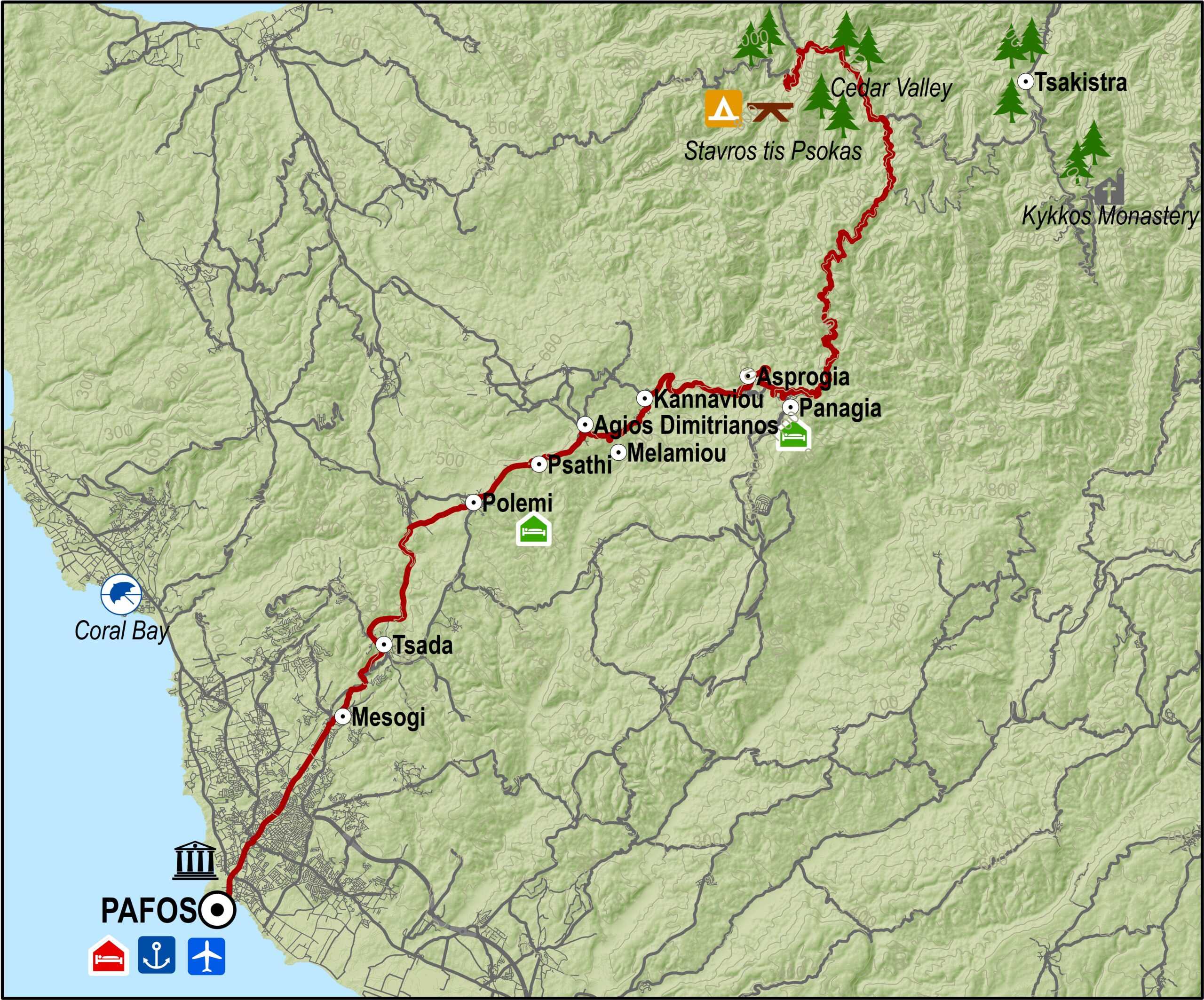
From the forestry station at Stavros tis Psokas, the road then climbs a little further up to the largest village in the area, Panagia, the birthplace of Archbishop Makarios III, the first President of Cyprus. The Monastery of Panagia Chrysorrogiatissa is situated near this village.
The route continues towards Pafos, going through the villages of Asprogia, Kannaviou, Agios Dimitrianos, Psathi, Polemi, Kallepeia, Tsada and Mesogi.
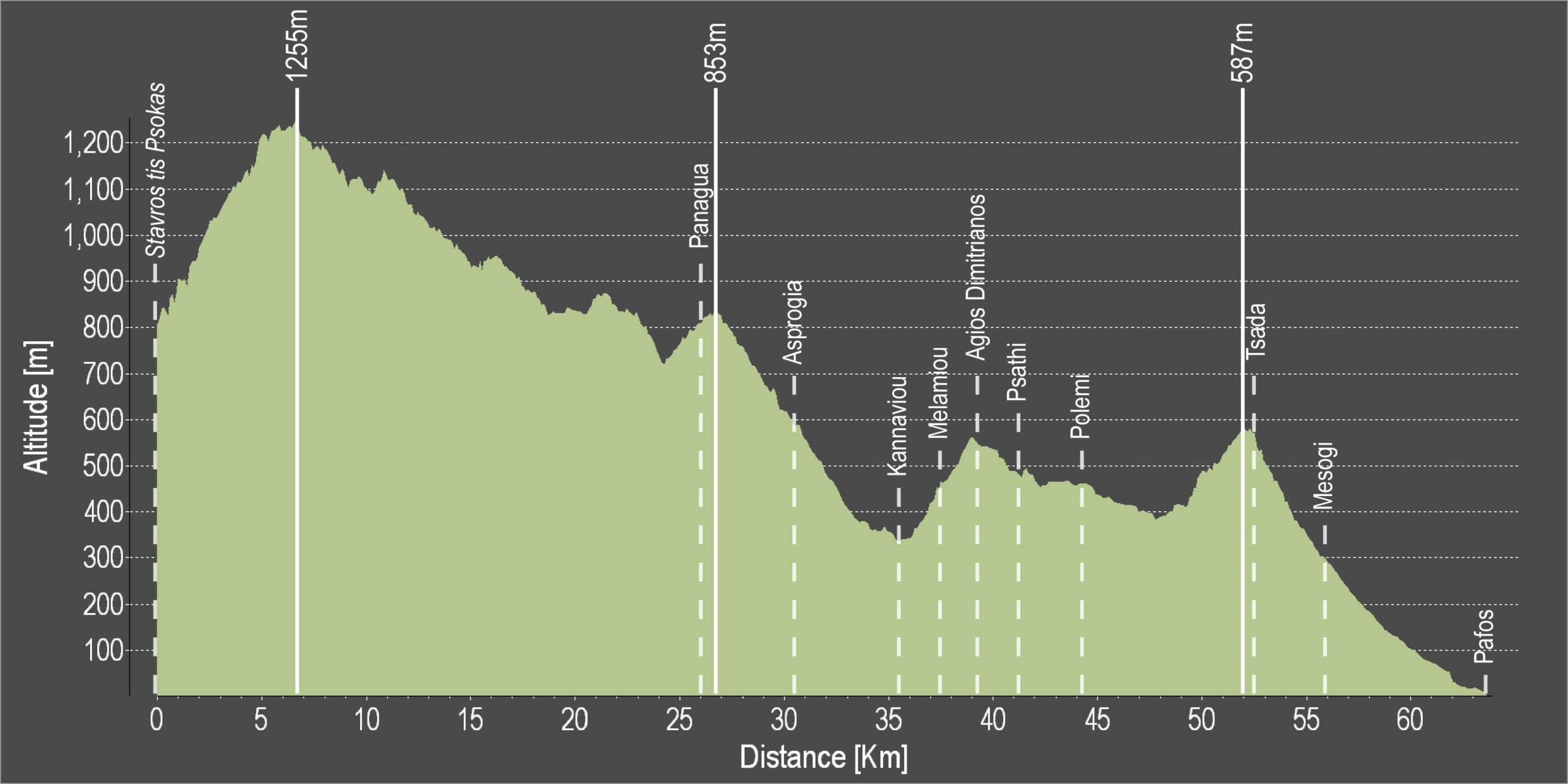
Difficulty rate: Despite being mostly downhill, there are quite a few steep uphills
Road condition: The route is entirely on paved roads.
Route Description: This excursion links the mountainous areas of Troodos and Kykkos with Pafos.
To download the route in gpx format click here
| Distance: | 64.2km |
| Elevation Gain: | 2251m |
| Highest point: | 1255m |
| Lowest point: | 1m |
| Loop: | NO |
| Terrain: | Mountain |
| Road surface: | Paved |
| Section Distance (km) | Total Distance (km) | |
| Stavros tis Psokas | 0,0 | 0,0 |
| Panagia | 26,6 | 26,6 |
| Asprogia | 3,9 | 30,5 |
| Kannaviou | 5,1 | 35,6 |
| Melamiou | 2,0 | 37,6 |
| Agios Dimitrianos | 1,6 | 39,2 |
| Psathi | 1,9 | 41,1 |
| Polemi | 3,1 | 44,2 |
| Tsada | 8,3 | 52,5 |
| Mesogi | 3,5 | 56,0 |
| Pafos | 8,2 | 64,2 |