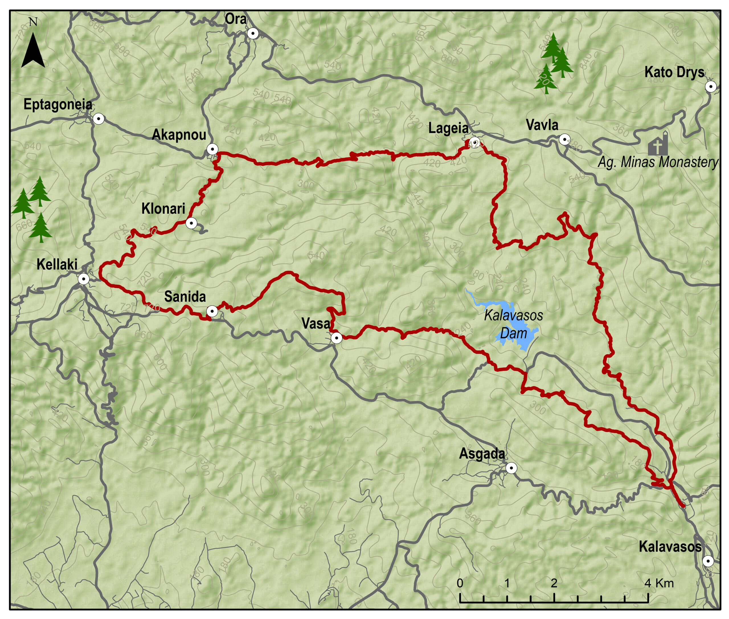
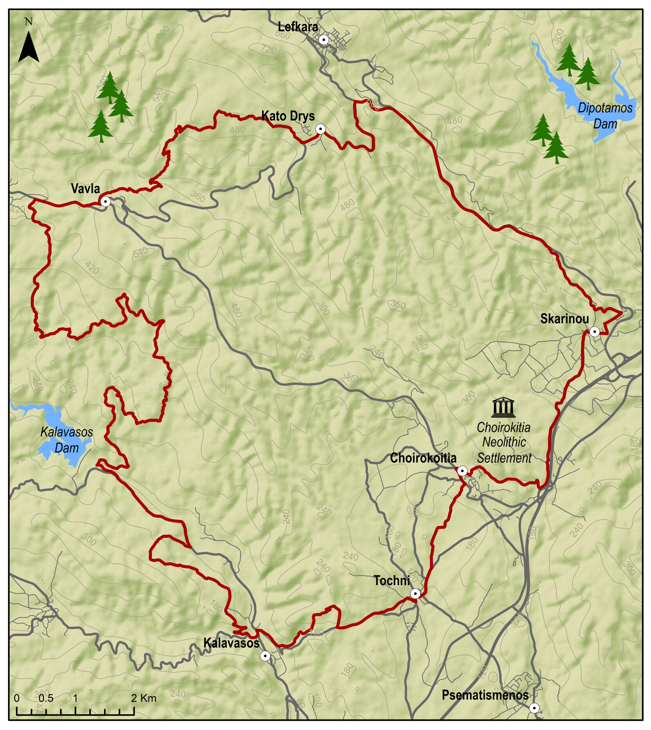
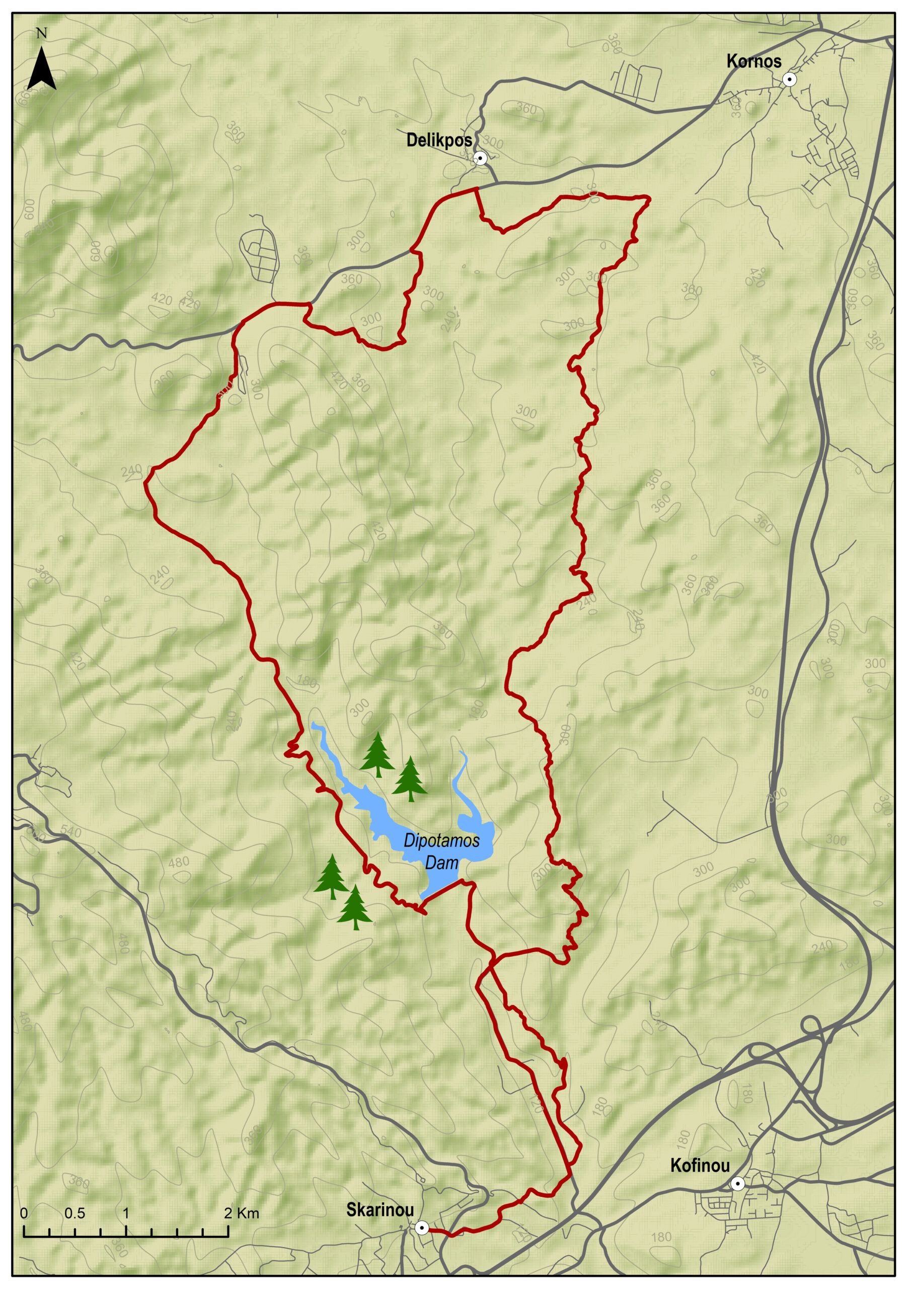
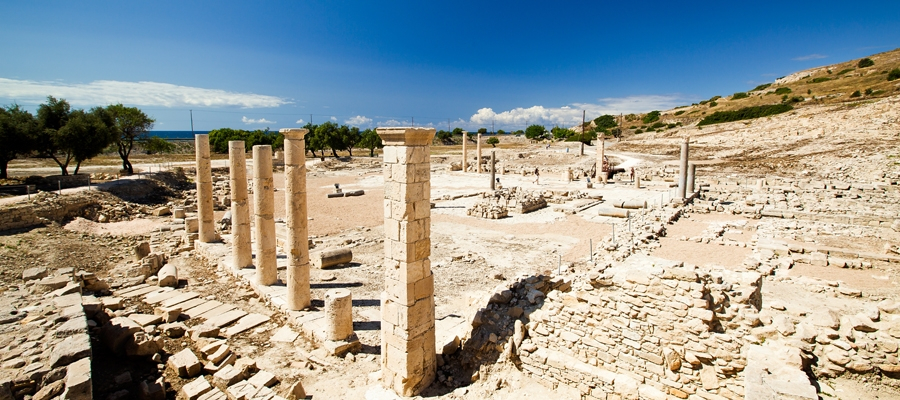
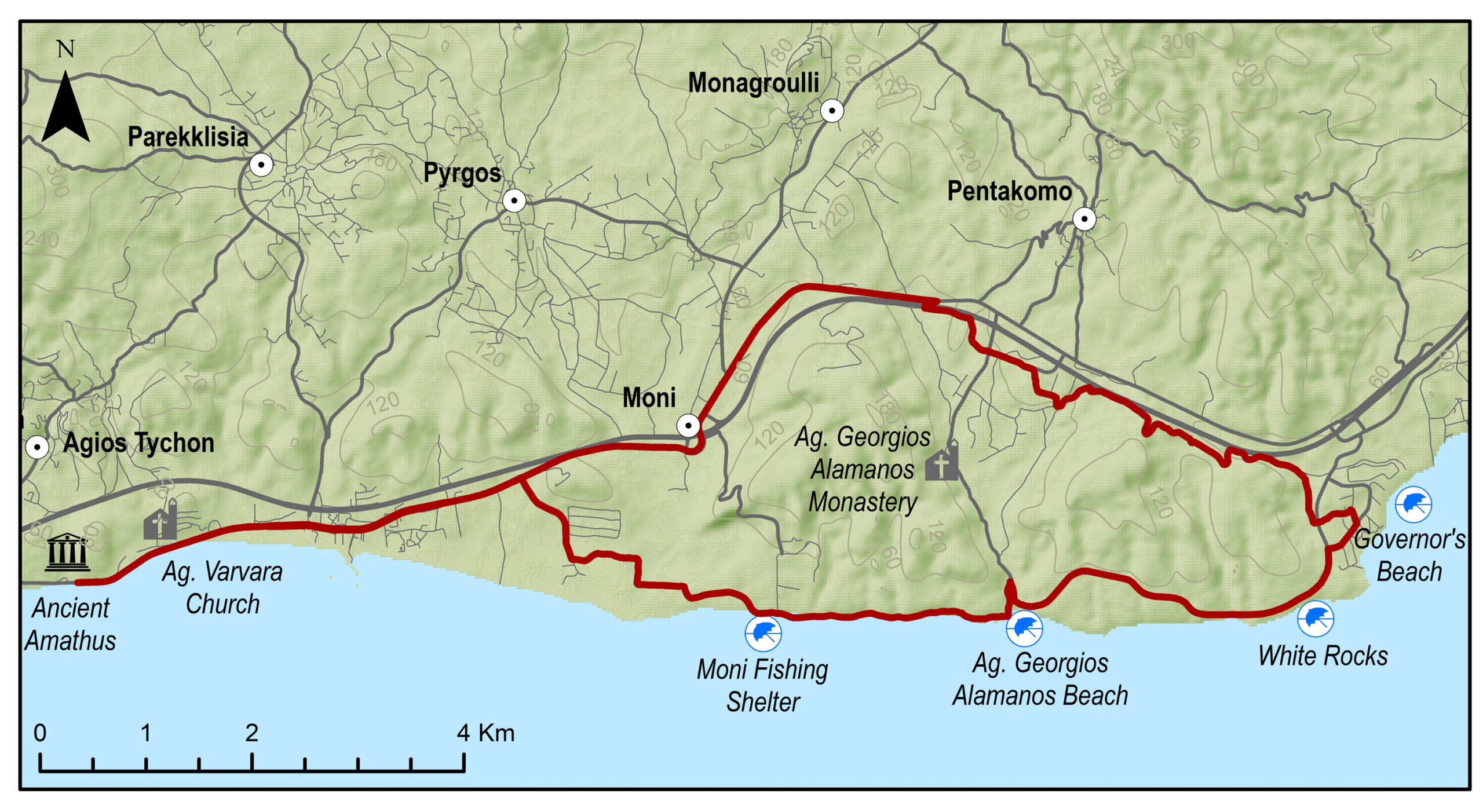
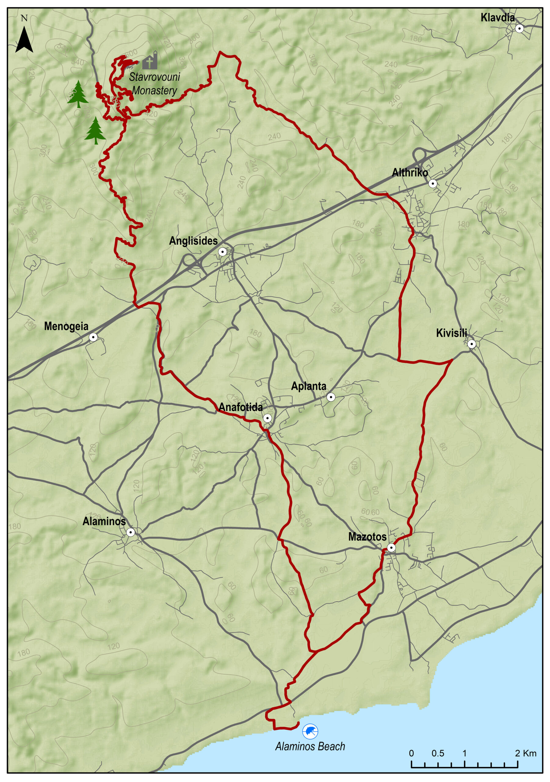
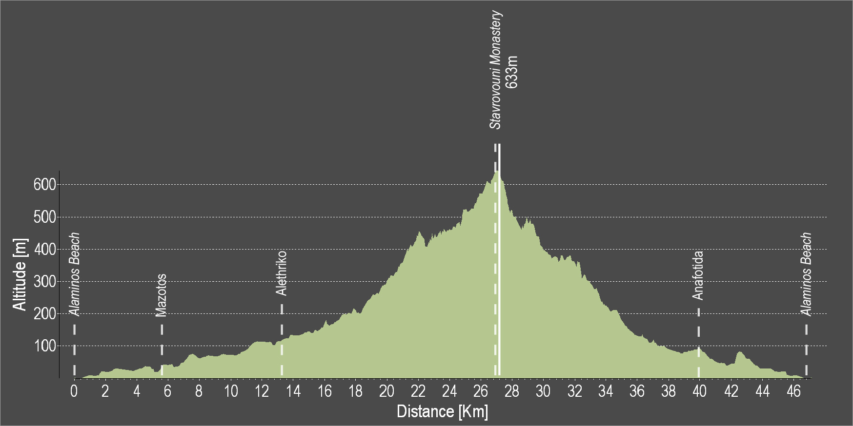
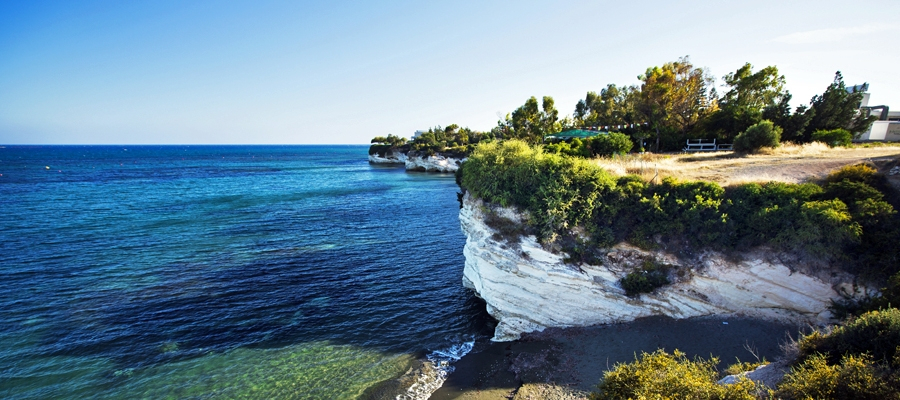
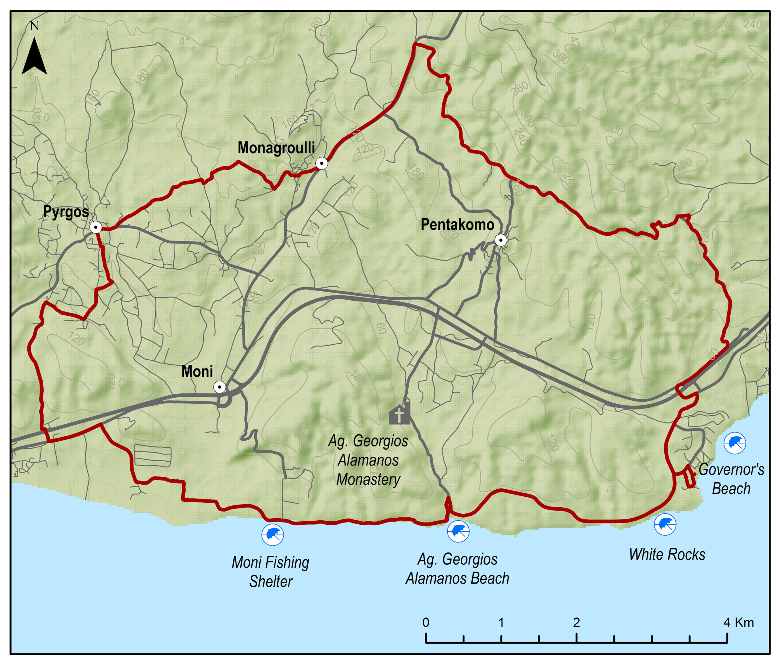
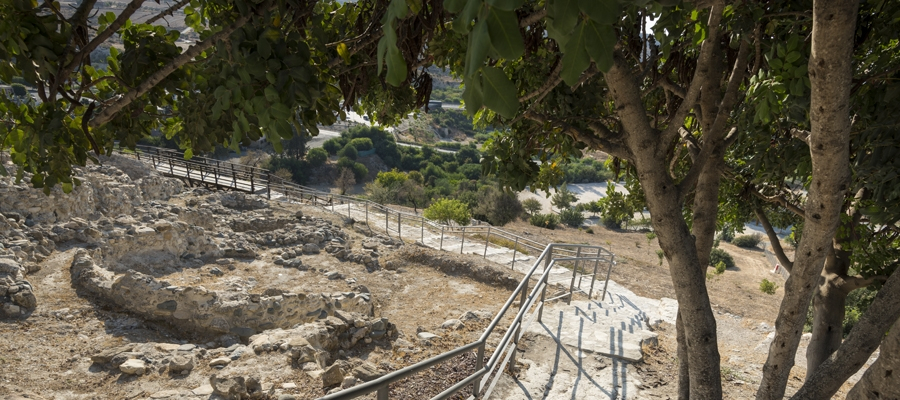
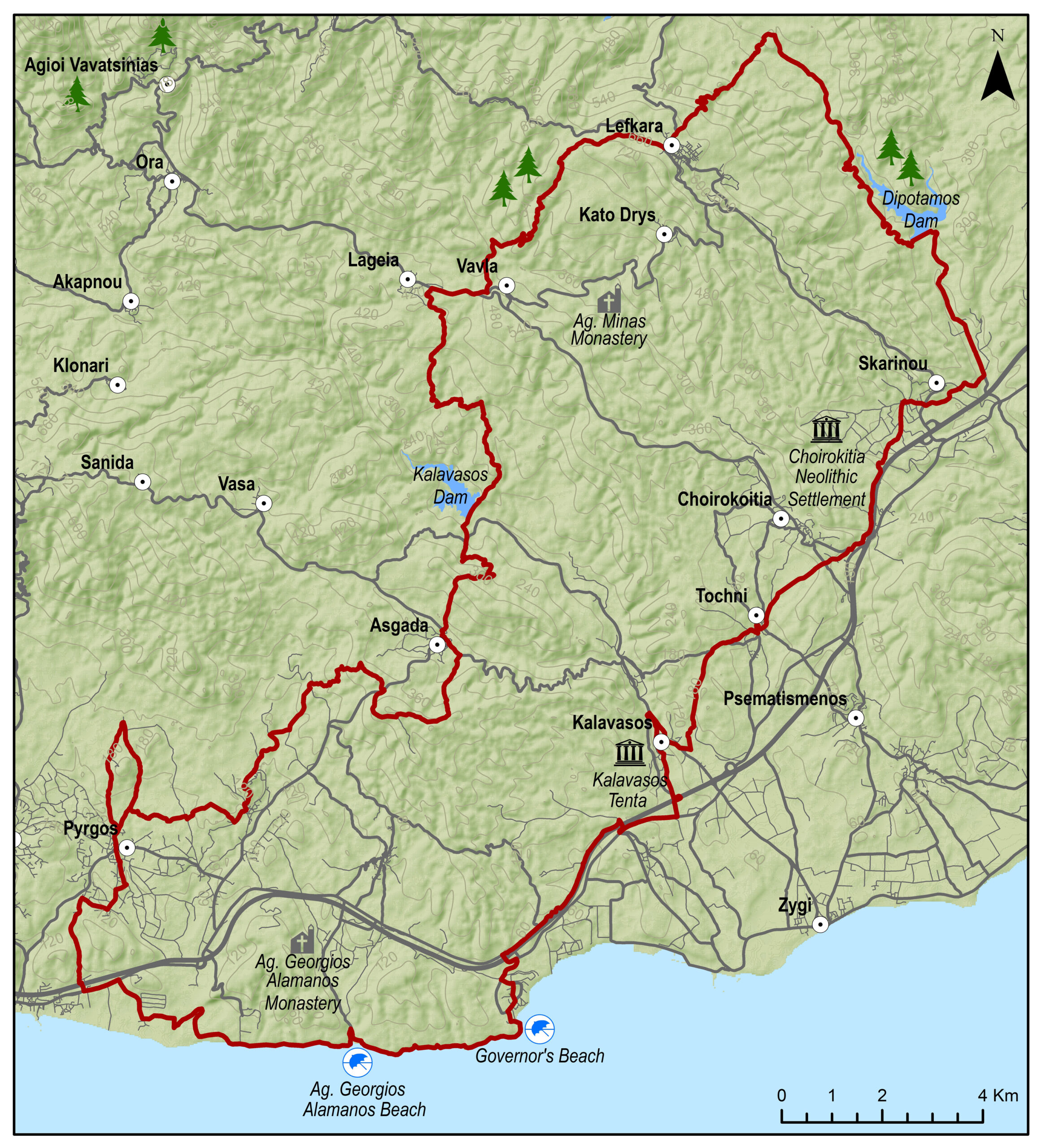
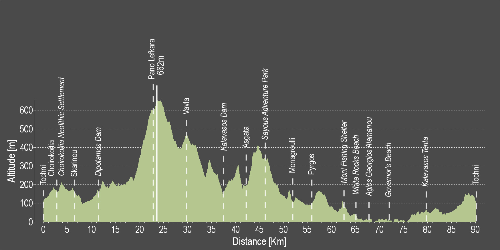
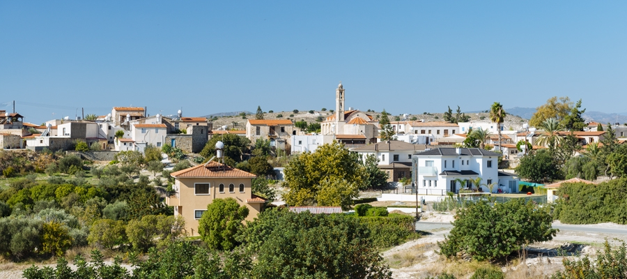
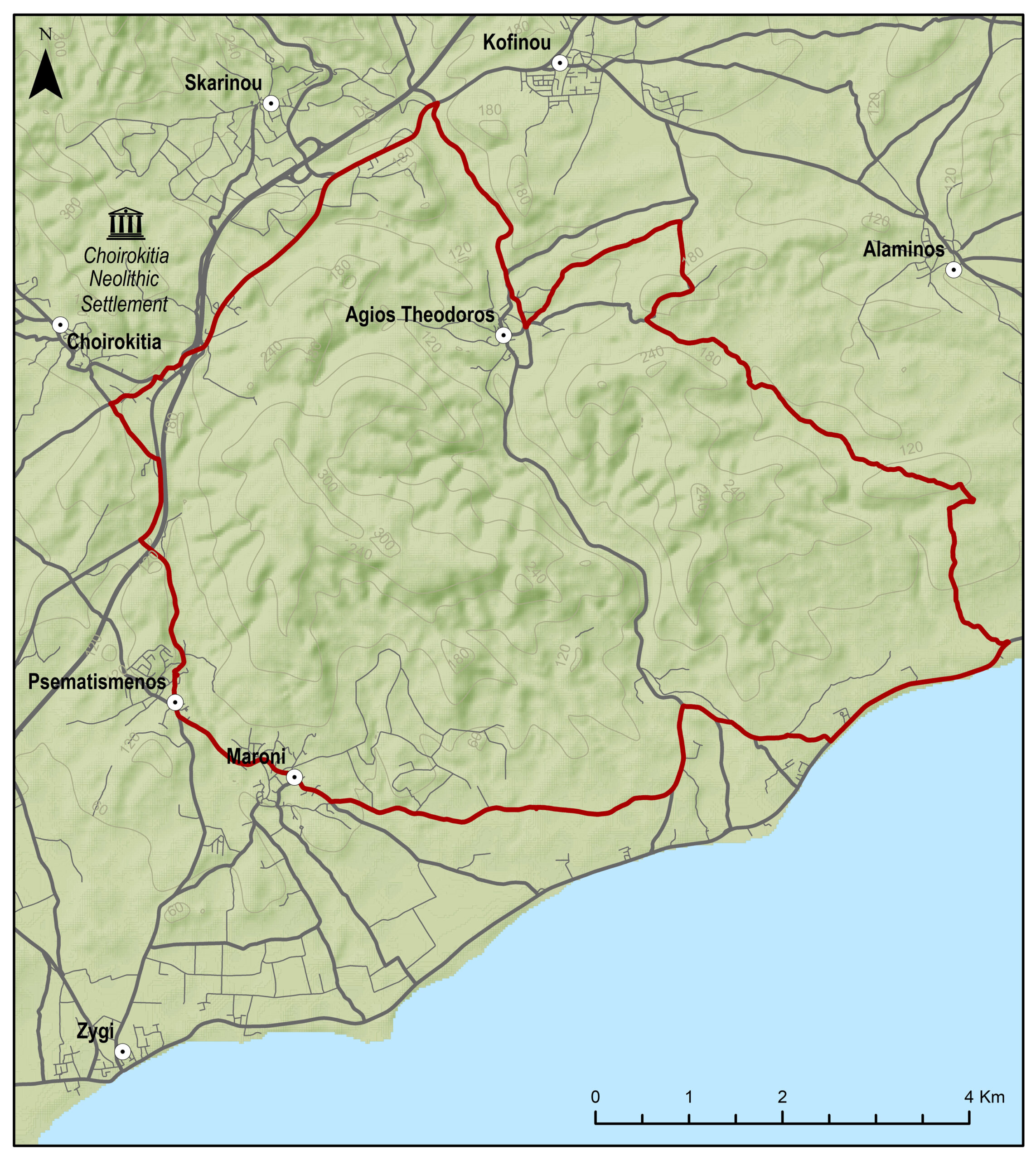
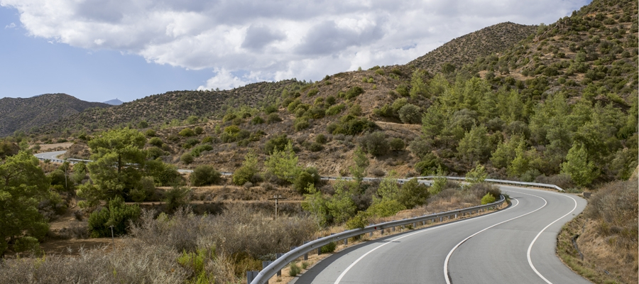
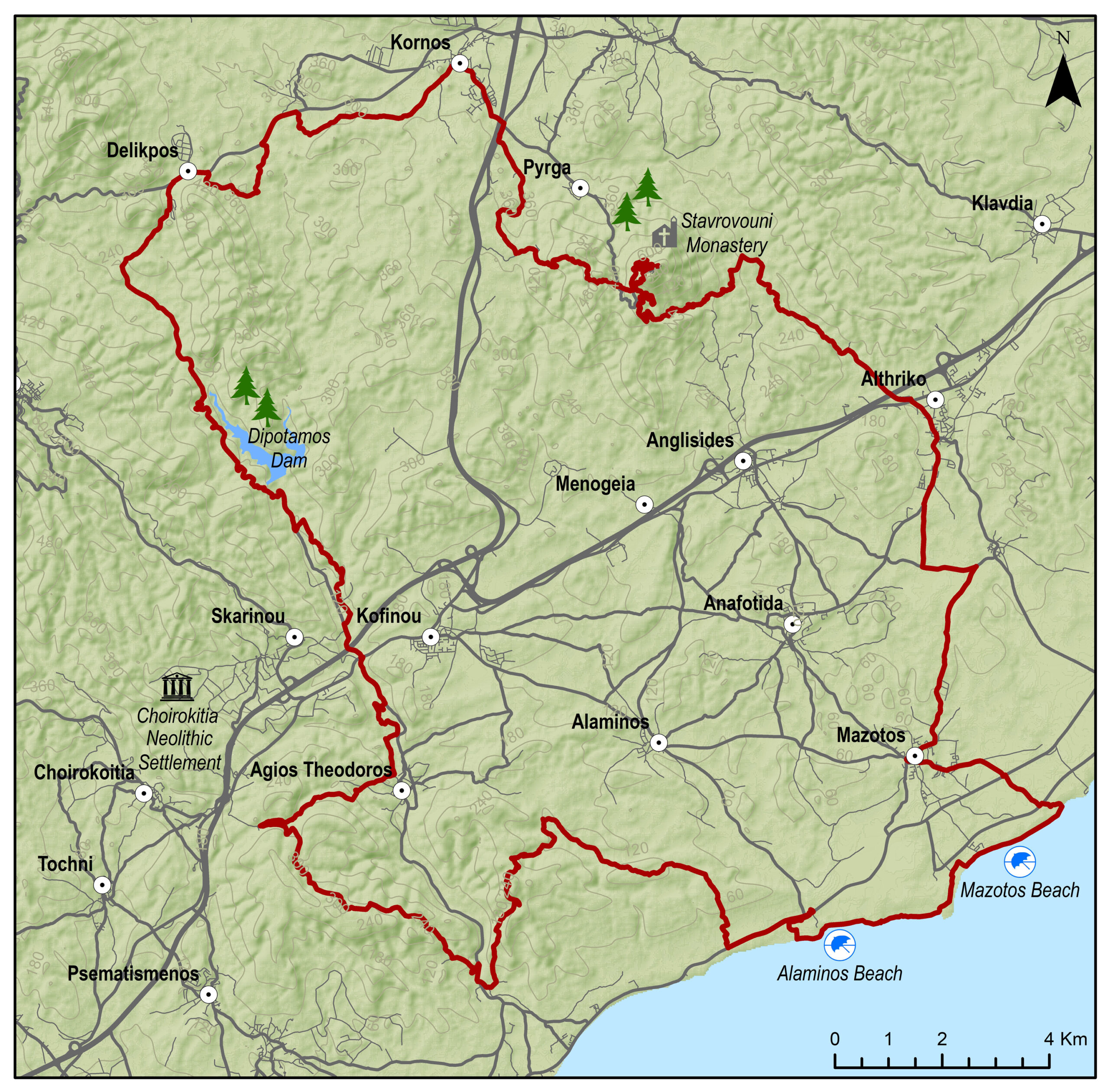
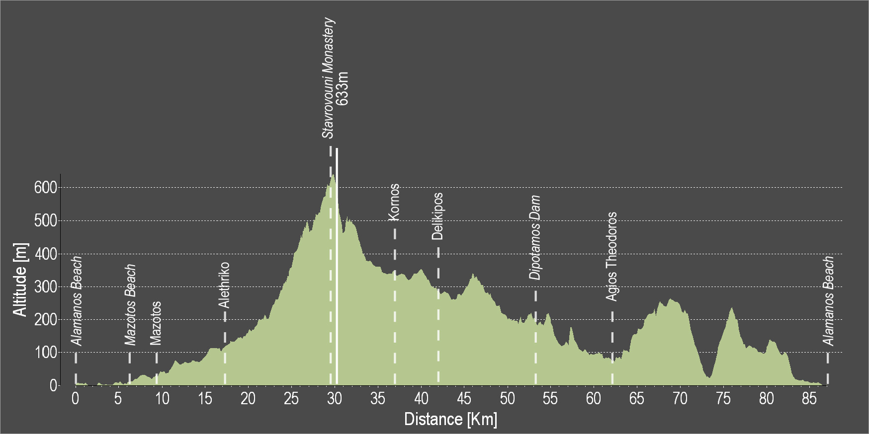
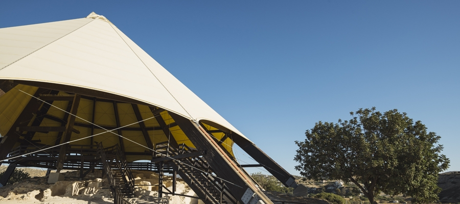
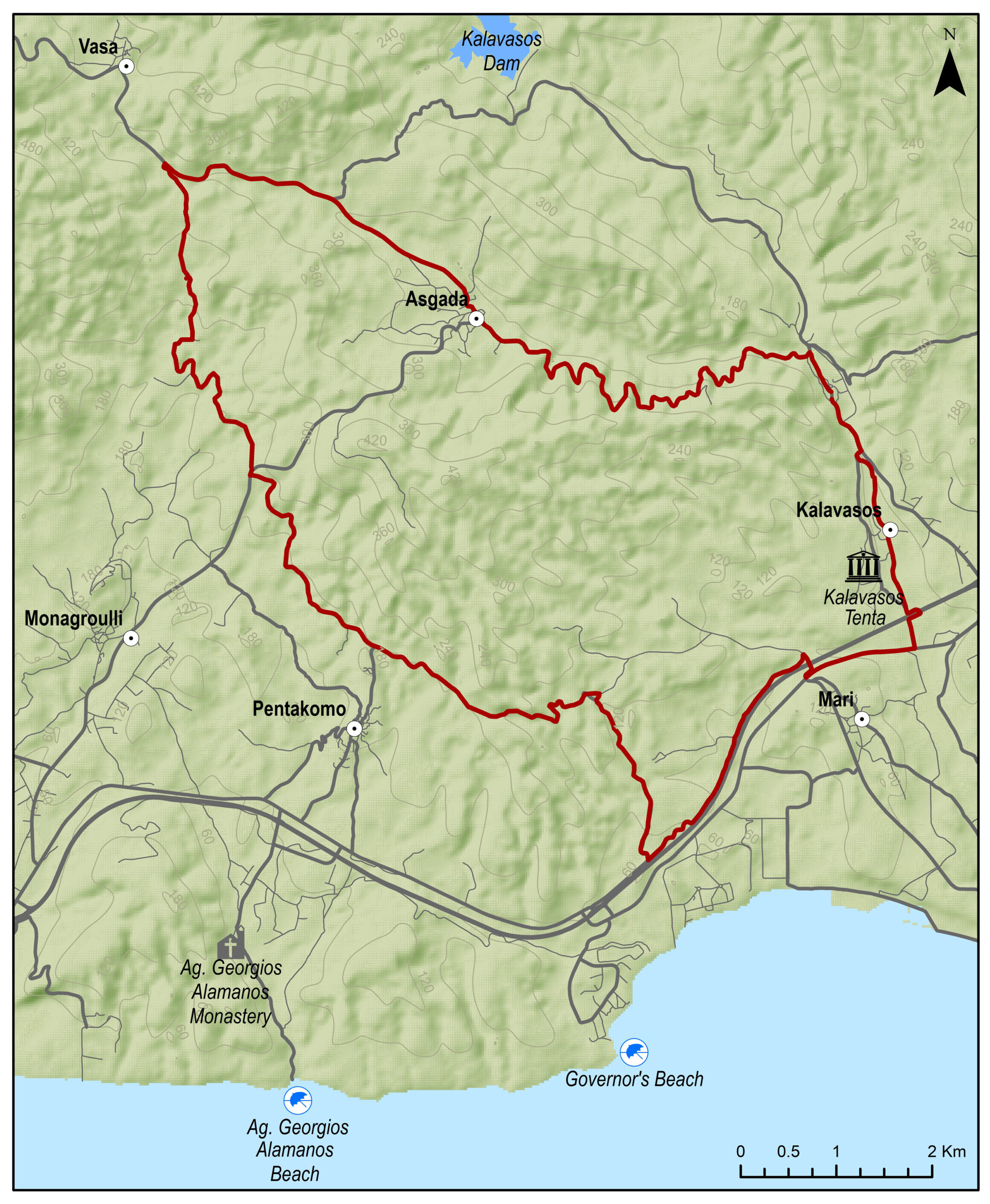
The route starts from the beautiful Tochni and heads to Choirokoitia, where the Neolithic Settlement of Choirokoitia lies, which has been listed as a UNESCO World Heritage Site since 1998. Continue onwards to the village of Skarinou and the Dipotamos Reservoir before heading downhill to the village of Lefkara, known for its traditional embroidered lace and silver wire crafts. The route proceeds to the village of Vavla, the Kalavasos Reservoir and the village of Asgata, before passing by the adventure theme park, and then descend to Monagroulli and Pyrgos. Continue along the coast, passing by the Moni Fishing Shelter, the impressive White Rocks coastal area, the beach of Agios Georgios Alamanos and the Governor’s Beach. Before reaching Tochni, you can pass by the Tenta Neolithic Settlement dating back to 7000 BC. It is one of the most important Neolithic Settlements on the island and is sheltered by a distinctive cone-shaped roof, which is a contemporary architectural intervention in the landscape.
To download the route in gpx format click here
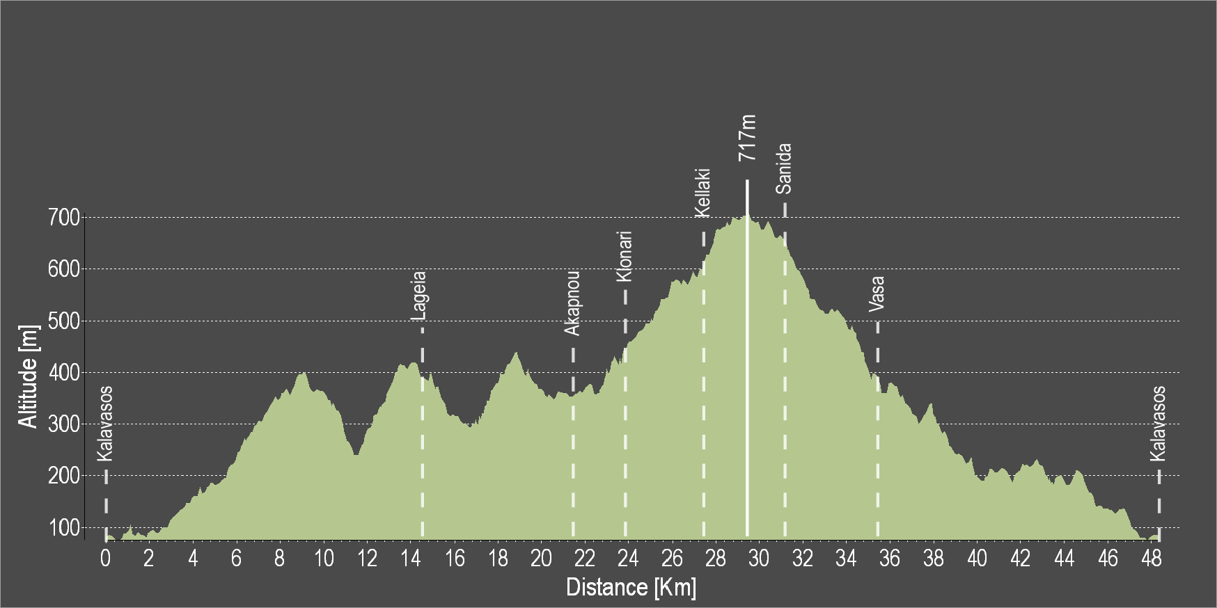
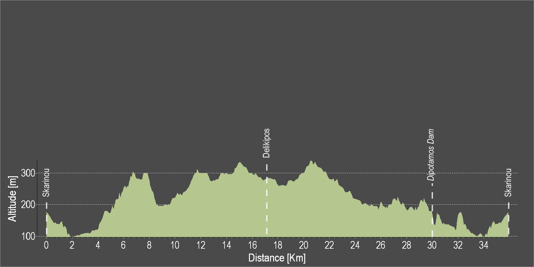
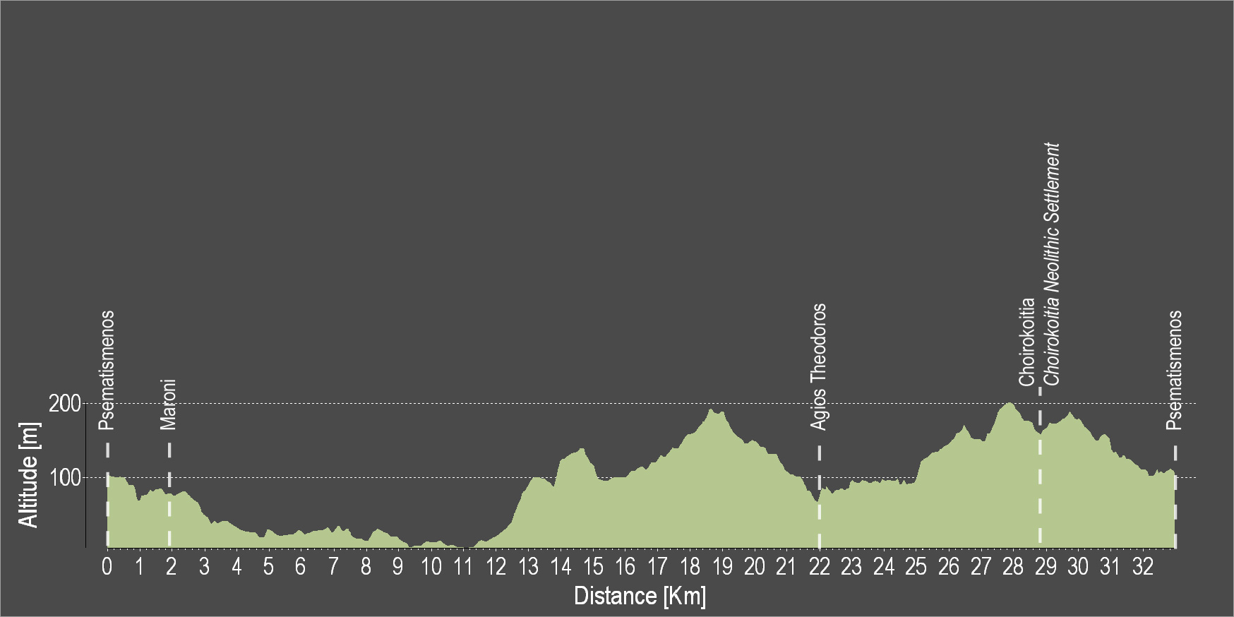
| Distance: |
90.9km |
| Elevation Gain: |
1811m |
| Highest point: |
662m |
| Lowest point: |
0m |
| Loop: |
YES |
| Terrain: |
Mountain |
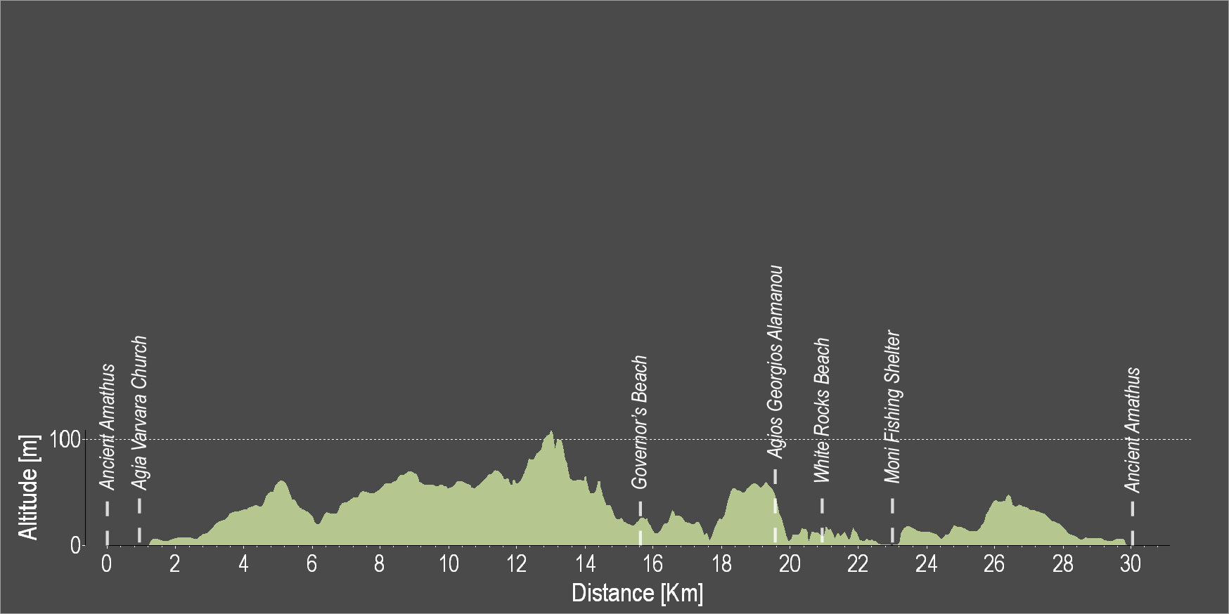
|
Section Distance (km) |
Total Distance (km) |
| Tochni |
0.0 |
0.0 |
| Choirokoitia |
2.2 |
2.2 |
| Choirkoitia Neolithic Settlement |
0.0 |
2.2 |
| Skarinou |
4.8 |
7.0 |
| Dipotamos Dam |
4.8 |
11.8 |
| Pano Lefkara |
10.9 |
22.7 |
| Vavla |
6.9 |
29.6 |
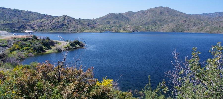
| Kalavasos Dam |
8.4 |
38.0 |
| Asgada |
4.2 |
42.2 |
| Sayous Adventure Park |
4.1 |
46.3 |
| Monagrouli |
6.0 |
52.3 |
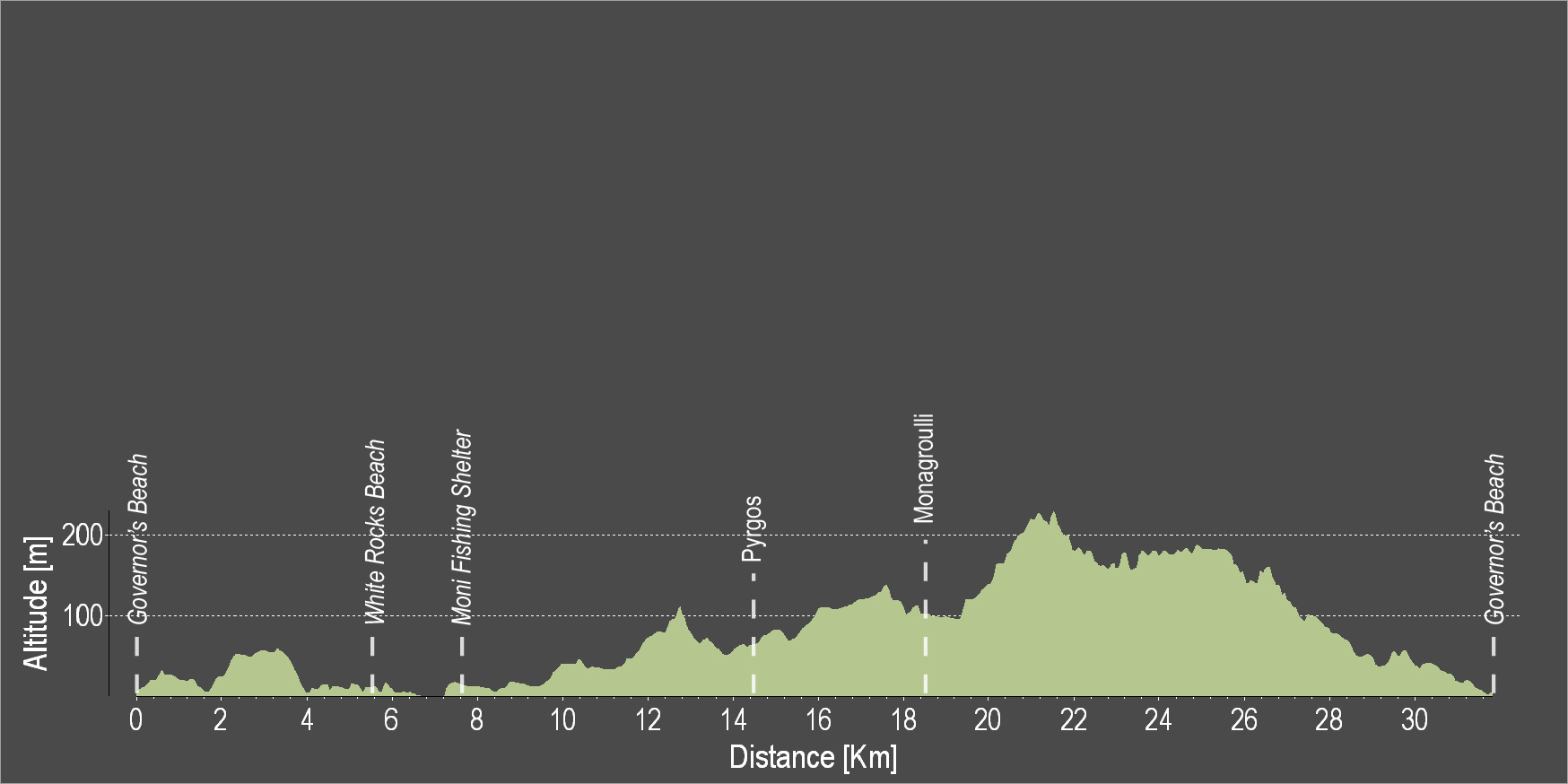
| Pyrgos |
8.7 |
61.0 |
| Moni Fishing Shelter |
7.8 |
68.8 |
| White Rocks Beach |
2.0 |
70.8 |
| Agios Georgios Alamanos Beach |
1.1 |
71.9 |
| Kalavasos Tenta |
12.7 |
84.6 |
| Tochni |
6.3 |
90.9 |