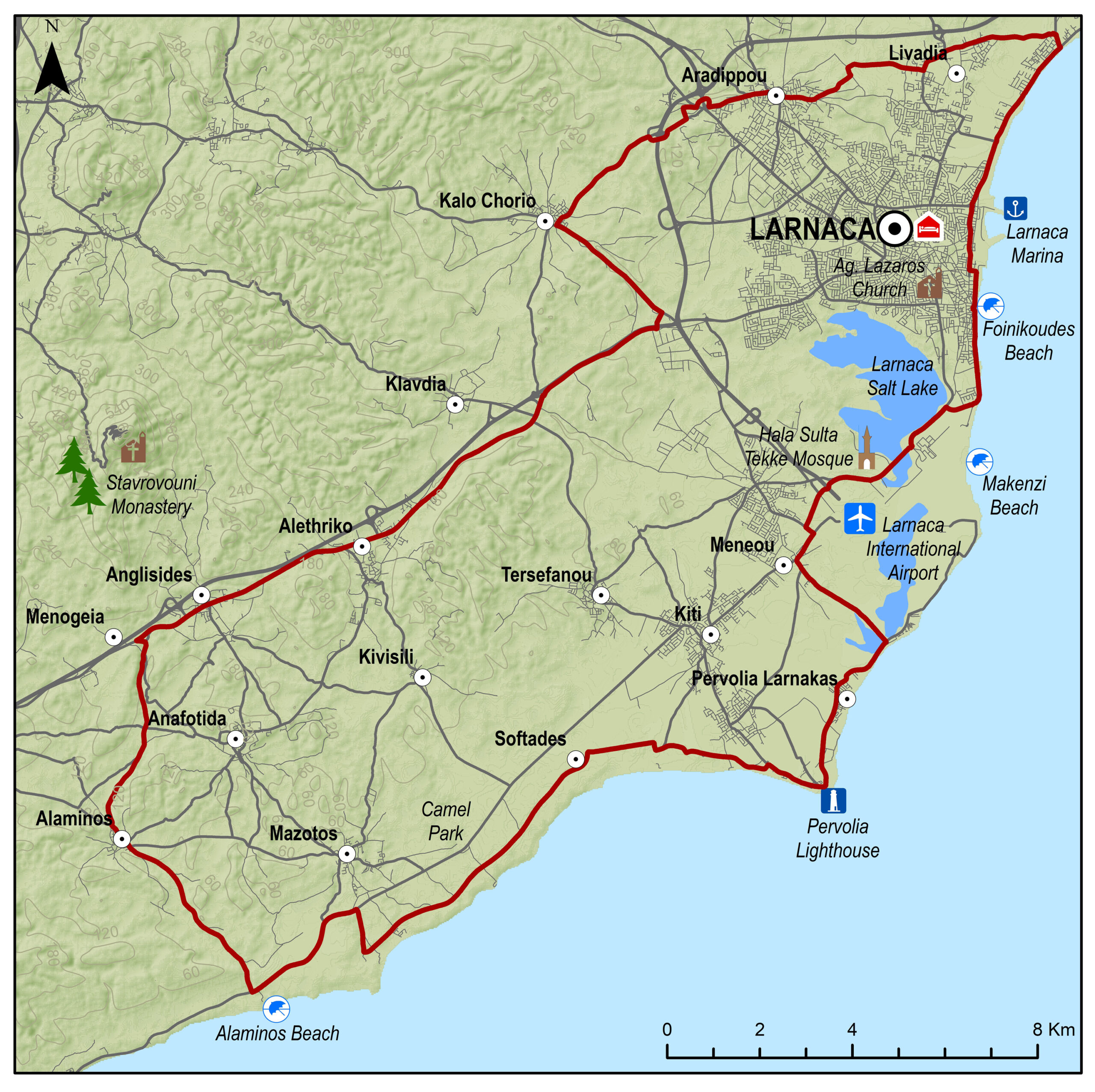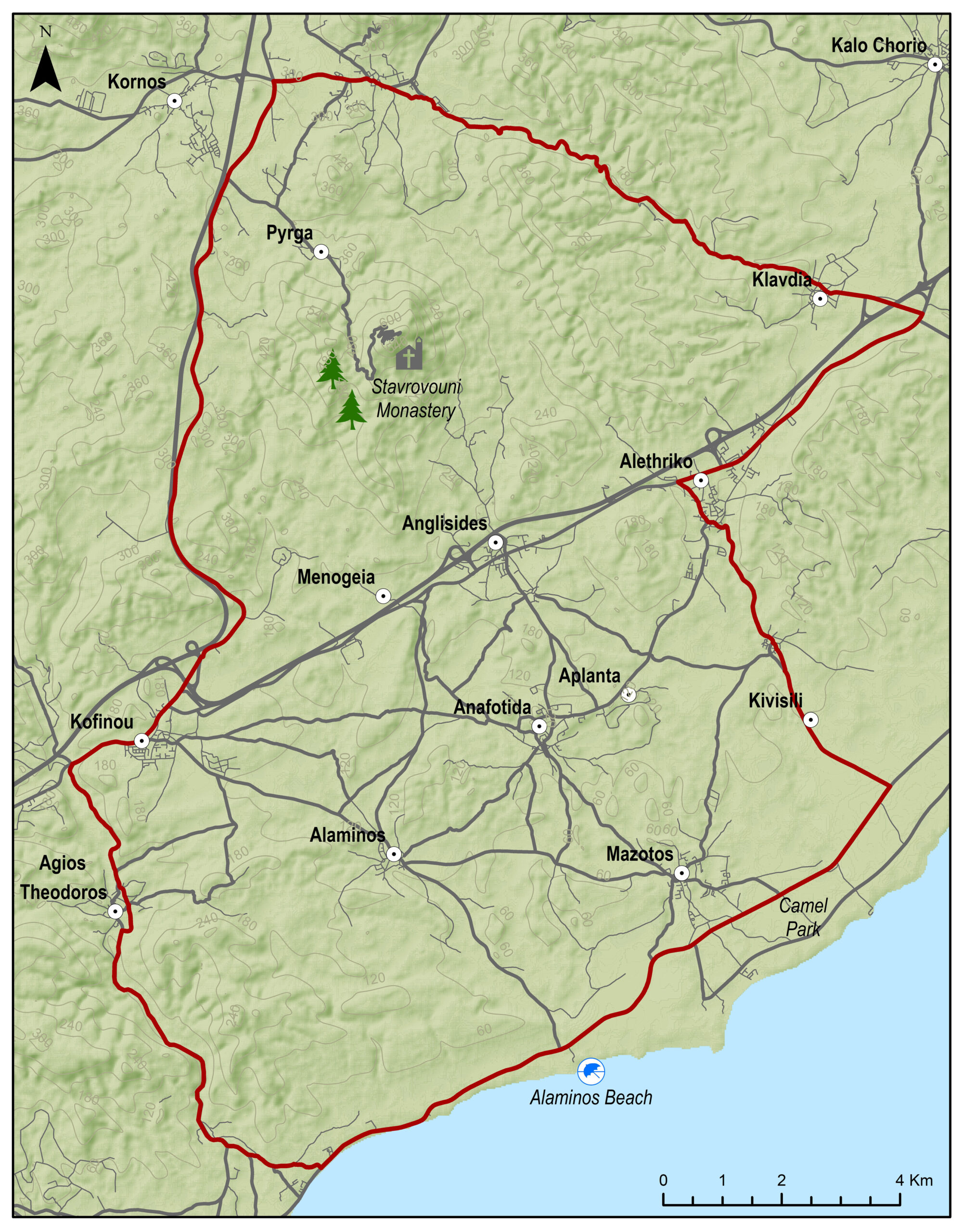
Alaminos Fishing Shelter – Perivolia – Larnaka (Larnaca) – Kalo Chorio - Anglisides – Alaminos – Alaminos Fishing Shelter
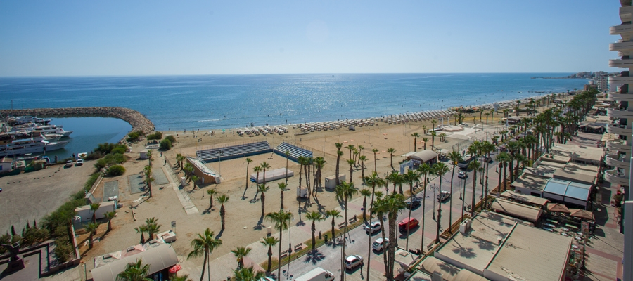
Eine entspannte Runde zunächst am Meer, vorbei am Leuchtturm in Perivolia und seinem Vorgänger, dem Turm der Regina – einst Teil einer venezianischen Signalkette. Weiter geht es entlang des Salzsees von Larnaca, einem der wichtigsten Feuchtgebiete Zyperns und Heimstatt für 85 Wasservogelarten. Rollen Sie entlang der Larnaca Promenade “Foinikoudes” und der Strände östlich des Zentrums. Nach dem Stadtleben geht es zurück durch die sanften, sandigen Hügel des Hinterlandes über Kalo Chorio, Anglisides und Alaminos.
Bitte klicken sie hier zum download die beschreibung der route.
Bitte klicken sie hier zum download die route im gpx-format.
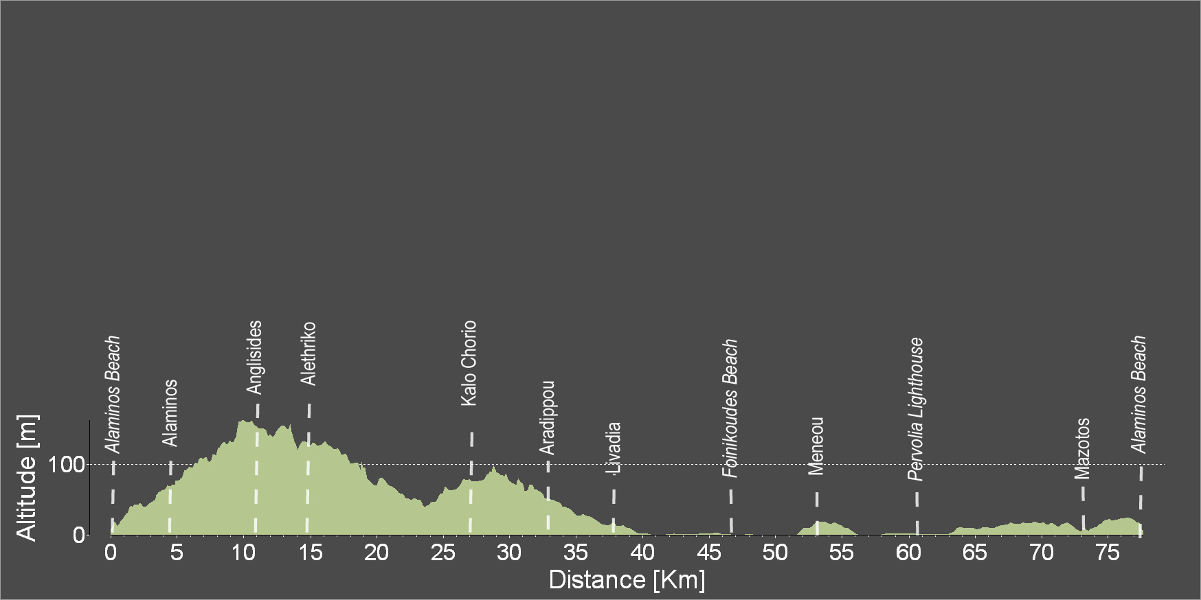
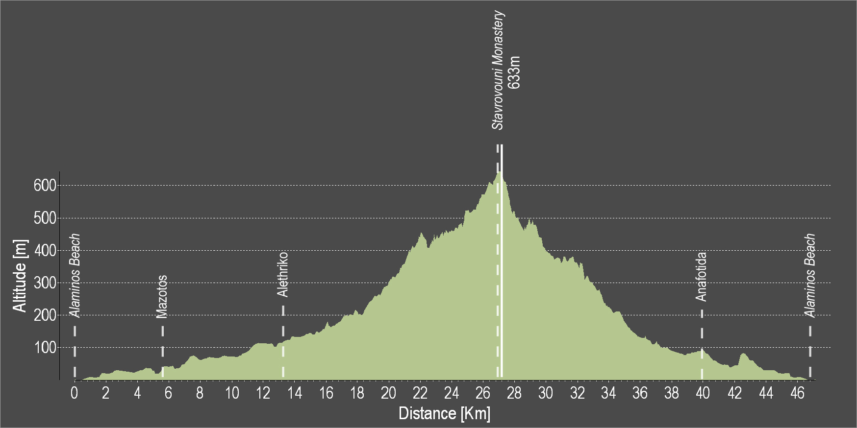
| Distance: | 77.0km |
| Elevation Gain: | 306m |
| Highest point: | 163m |
| Lowest point: | 0 |
| Loop: | YES |
| Terrain: | Flat |
| Road surface: | Paved |
| Section Distance (km) | Total Distance (km) | |
| Alaminos Beach | 0.0 | 0.0 |
| Alaminos | 4.4 | 4.4 |
| Anglisides | 6.2 | 10.6 |
| Alethriko | 3.8 | 14.4 |
| Kalo Chorio | 11.8 | 26.2 |
| Aradippou | 6.7 | 32.9 |
| Livadia | 5 | 37.9 |
| Foinikoudes Beach | 8.6 | 46.5 |
| Meneou | 6.8 | 53.3 |
| Pervolia Lighthouse | 7.2 | 60.5 |
| Mazotos | 13.2 | 73.7 |
| Alaminos Beach | 3.3 | 77 |